
Forecasting the climate: new model dials up the data and the detail
30 August 2018
Climate prediction (or long-range forecasting) tells us which way our climate will lean over the coming months or seasons. It's made possible by a climate model—and the one we use has just become a whole lot more powerful. This means increased accuracy and more localised information—giving you improved tools to plan for our harsh climate.
The Bureau's Climate Outlooks are now powered by a new state-of-the-art high-definition climate model. This milestone is a significant step forward for the system that generates our monthly and seasonal outlooks for rainfall and temperature.
Details create the big picture
The upgraded model, known as the Australian Community Climate and Earth System Simulator—Seasonal (ACCESS-S) was developed in collaboration with the UK Met Office. It uses the physics of the atmosphere, oceans, land and ice and their multiple interactions to calculate likely rainfall and temperature patterns over the months and season ahead.
ACCESS-S runs on the Bureau's supercomputer named 'Australis'—it is 16 times more powerful than our previous supercomputer. With that extra computing power, we can run our new model at a higher resolution, shifting from a 250 km grid to a more location-specific 60 km grid. The improved resolution gives a better representation of how local land features affect the climate of surrounding areas. Watch this short video for an explanation of how finer resolution changes things.
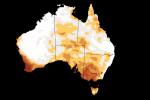
The rainfall outlook maps below illustrate the change. The map on the left was generated by the old model, and the one on the right is from ACCESS-S. The improved resolution is evident in the forecast over Tasmania. The left-hand map suggests no strong push towards a wetter or drier than average season for the State, but the right-hand map shows that much of Tasmania is likely to be drier than average with strongest chances of a dry spring in the northwest. Similarly, southwest Western Australia has a more detailed pattern of chances for a dry season with the new model compared to the more general pattern of chances in the outlook from the older model.
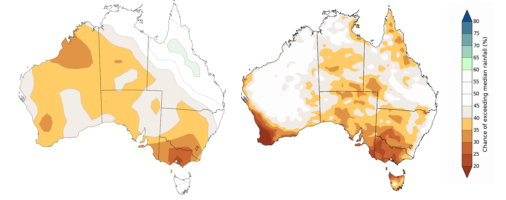
Maps: Spring 2018 rainfall outlooks from the old model (left, not released) and new model (right) showing the chance of receiving above-average seasonal rainfall.
The new model better represents the Great Dividing Range—the eastern highlands stretching from Queensland to Victoria—which plays a key role in influencing localised differences in rainfall and temperature across eastern Australia. The spring rainfall outlook map from new model shown above illustrates the role the Great Dividing Range can play. Areas on the coastal side of the Great Dividing Range in New South Wales have roughly equal chances of above- or below-average rainfall, whereas the interior side of the Great Dividing Range favours below-average rainfall. The new, higher-resolution model can better differentiate between climate zones and make better forecasts for geographically complex regions.
More than just rainfall and temperature outlooks
It's not just the climate modelling of land areas that is improving, ocean forecasting also gets a big boost, moving from a 150 km grid to a 25 km grid. The 25 km grid can see ocean features, such as small-scale currents and eddies in the East Australian Current. Their impact on our climate will be determined for the first time, improving outlook accuracy and the potential for future marine applications. ACCESS-S will also be used to forecast coral bleaching risk and seasonal streamflows.
The future of forecasting
The new model is just one of a suite of improvements for our Climate Outlooks service. In August 2017 we moved from monthly to twice-monthly Climate Outlook releases. With outlooks issued more frequently, the Australian community can adjust to conditions as they unfold and get an early look at the season ahead.
In 2019 we'll start issuing outlooks for two-week periods, alongside the monthly and three-monthly outlooks. This will fill the current gap between seven-day weather forecasts and the monthly and seasonal climate outlooks. For the first time you will get advice on what is likely to happen in the weeks (rather than months) ahead. At the same time, we'll begin issuing Climate Outlooks every week—so the very latest information will be at your fingertips more regularly.
More information
Visit the Bureau’s website to view the latest outlook or subscribe now to receive climate outlooks direct via email.
Long-range forecasts: how are Climate Outlooks made?

Subscribe to this blog to receive an email alert when new articles are published.
Comment. Tell us what you think of this article.
Share. Tell others.