


Cold & Snow & Possible Rain: NSW-ACT Update (Interview)
08/06/2021
Please find below the link to an on-camera interview with the Bureau of Meteorology's Melody Sturm, with an update on the weather system beginning to impact NSW and the ACT:http://we.tl/t-4x8LgV9lEi
- Much of NSW and the ACT will experience a significant drop in temperatures over coming days, with some areas expected to be more than 10 degrees below average, and many areas expected to be more than five degrees below.
- Significant snow falls are expected around the region over coming days, including areas of the Northern Tablelands, the Central Tablelands, and the Southern Ranges.
- Snow levels are likely to drop to 800m and could even fall as low as 500m. This could include locations such as Oberon, Orange, Barrington Tops, the Blue Mountains, Guyra, Armidale and Glen Innes.
- Strong and gusty winds are likely to begin in some areas from Tuesday
- Snow and ice may lead to dangerous driving conditions
- Damaging winds are expected over the NSW Alps and possibly on the South Coast, and northern ranges
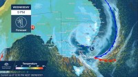
- Storms associated with the Cold Front are currently occuring in parts of western NSW and will continue tracking east through this afternoon and this evening
- There is a risk of heavy rain in the south-east later in the week, and people in that area should watch for updates
- While an East Coast Low is expected to the develop in coming days, it should be noted that most impacts are likely to occur on the Victorian side of the border. However, these types of weather systems can be quite dynamic and people in southern regions should continue to monitor conditions and warnings
Due to levels of interest it is likely there will be a Media Conference at our Sydney office at 1pm tomorrow (Wed)
