
El Niño WATCH—everything you ever wanted to know but were afraid to ask
13 June 2017
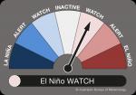
The ENSO Outlook helps keep tabs on the likelihood of an El Niño—or La Niña—developing in the months ahead. But what does it actually mean when the needle points to El Niño WATCH?
The ENSO Outlook assesses the likely evolution of the El Niño–Southern Oscillation—the cycle of El Niño, La Niña and neutral conditions in the Pacific Ocean. It uses a staged approach to warn of the likelihood of an El Niño or La Niña in the months ahead.
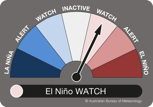
When the needle is at El Niño WATCH it means that in past years with similar conditions, around 50 per cent of the time an El Niño has subsequently formed. We summarise this by saying that there is about a 50 per cent chance of an El Niño developing in the months ahead. While a 50 per cent chance may sound like just tossing a coin, it is actually double the normal likelihood of an El Niño occurring in any year. El Niño WATCH is certainly not a guarantee that El Niño will happen, but it is an indication that some of the typical precursors are in place.
There is also about a 50 per cent chance that these early signals are just shorter-term fluctuations, and ENSO will remain in its neutral phase, or even move to La Niña.
When an El Niño WATCH is declared it's time to think about possible actions, and what it could mean for you, should an El Niño develop.
So where to next from El Niño WATCH?
The three stages of the ENSO Outlook are designed to reflect the level of confidence that climatologists have that an ENSO event may occur in the months ahead.
For a stage to be reached, our climatologists assess whether a set of observed atmospheric and oceanic criteria—the typical precursors to an event—have been met. They also review eight international climate models to see how many are forecasting an event in the months ahead.
Once the ENSO Outlook status has reached El Niño WATCH, there are three possible paths: we could stay at El Niño WATCH; move up to El Niño ALERT; or the El Niño WATCH could be cancelled, moving the dial to INACTIVE.
For example, in April 2005 the El Niño WATCH weakened back down to INACTIVE. In contrast the El Niño WATCH the following winter strengthened to an El Niño ALERT before reaching EL NIÑO, meaning an event was declared.
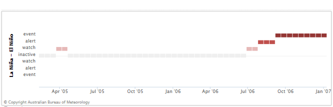
Image: ENSO Outlook values from April 2005 to January 2007
If the ENSO Outlook reaches El Niño ALERT it means that the chance of an El Niño later that year has increased to 70 per cent. Our ENSO Outlook criteria describe what needs to occur before we shift into El Niño ALERT.
So is it always a slow and steady change in likelihood?
In some instances things turn out differently to what's expected. Back in June 1986, El Niño conditions in the Pacific Ocean developed so quickly that the ENSO Outlook would have swung from INACTIVE to El Niño ALERT, skipping over El Niño WATCH entirely. The same thing would have happened in February 1993, but these rapid developments are the exceptions rather than the rule.
Sometimes the Pacific Ocean likes to tease us, threatening an event for months before it vanishes without ever having developed. In 2001 the ENSO Outlook would have pointed to El Niño WATCH for four months—late February to late July—before dropping back to INACTIVE.
And at other times it makes us wait before eventually delivering an event. For instance, in 2009 we were again in El Niño WATCH for four months (from late February to late July), before swinging through El Niño ALERT into El NIÑO in August, where we stayed until the following April.
Are there any effects on the Australian climate during El Niño WATCH?
The typical effects of El Niño—less rainfall and warmer daytime temperatures over eastern Australia during winter and spring—can still occur even if we approach El Niño but don't quite reach it.
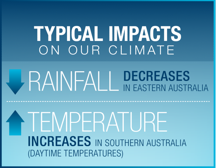
Image: Typical impact on Australia’s climate during an El Niño
Usually those impacts won't last as long or affect as large an area as would occur during a full-blown El Niño, since the weather patterns—typically stronger high pressure systems that mean less cloud and rain over Australia—may be influenced by the warming Pacific Ocean, but don't get locked in.
And essentially that’s what an El Niño declaration really means: out in the tropical Pacific the ocean has 'coupled' with the atmosphere, meaning the warmer oceans drive changes in the atmosphere, which in turn warms the ocean even more. When this positive reinforcement loop occurs we have an El Niño, and it typically doesn’t end until early the following year. Likewise the weather patterns over Australia stay locked in until then too.
So keep an eye on our ENSO Outlook to prepare ahead of time for potentially challenging—or rewarding—climate conditions.
Check our ENSO Outlook, which is updated fortnightly with the ENSO Wrap-Up.
More information
Currents of change: Tracking the El Niño/La Niña cycle

Subscribe to this blog to receive an email alert when new articles are published—or sign up to receive a fortnightly email alert when the ENSO Wrap-Up is updated.
Comment. Tell us what you think of this article.
Share. Tell others.