
Weather data from the seas: the Australian Voluntary Observing Fleet
28 September 2017
A worldwide network of 4000 ships supplies ocean weather data to international weather agencies. The data are transmitted around the globe for the purposes of forecasting, which in return benefits the safety of life at sea and ocean navigation. The observations are also archived as a long-term record of the world's climate.
Why are marine weather observations important?
The ocean is a major driver of the global economy, carrying more than 90 per cent of world trade. Recognising this, national weather agencies and researchers regularly monitor ocean conditions, deliver marine services to support coastal management and safety at sea and also model how oceans affect the atmosphere.
The ocean has a close relationship with the atmosphere: observing weather, ocean surface and sub-surface conditions is vital for weather and seasonal climate forecasting, and for detecting global climate change and variability.
The importance of weather information to mariners was a driving force behind the establishment of many of the world's national meteorological services. Much of our knowledge of global climate was originally taken from the logs of sailing ships of the 18th and 19th centuries.
From early last century, marine weather forecasts improved the safety of shipping after new communications systems enabled mariners to transmit weather observations and receive forecasts.
The Bureau operates a number of marine observing networks to provide data for day-to-day weather forecasting for the Australian public and marine user communities. These data play a crucial role in coastal and high seas forecasts, as well as longer-range computer climate modelling. They are also used internationally as inputs to computer-based weather and ocean prediction systems, and for supporting seasonal-scale climate prediction of events such as El Niño/La Niña in the Pacific.
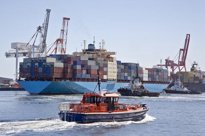
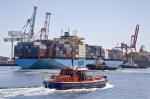
Image: The ocean is the highway of world trade and the shipping industry both uses marine and high seas forecasts, and contributes data to them.
The Australian Voluntary Observing Fleet
The Bureau's volunteer weather observation network comprises thousands of volunteers gathering weather, climate and water information across Australia. It also includes the Australian Voluntary Observing Fleet of about 70 Australian and foreign-owned merchant, research, passenger cruise and private vessels. These vessels voluntarily collect and provide marine weather observations while at sea, and as they travel in and out of Australia's ports.
The Bureau supplies the ships with the meteorological equipment and trains the crew. Most of the weather observations are for temperature, barometric pressure, waves, wind speed and direction, sea surface temperature, and visibility. Other ships drop probes every four hours on global shipping routes to measure the temperature of the ocean at the surface and down to 800 m depth.
Crews upload the information and their current position via satellite. As the Australian Voluntary Observing Fleet is part of the World Meteorological Organization's Voluntary Observing Ship Scheme (a fleet of approximately 4000 ships worldwide) the data are also shared with other weather services around the world.
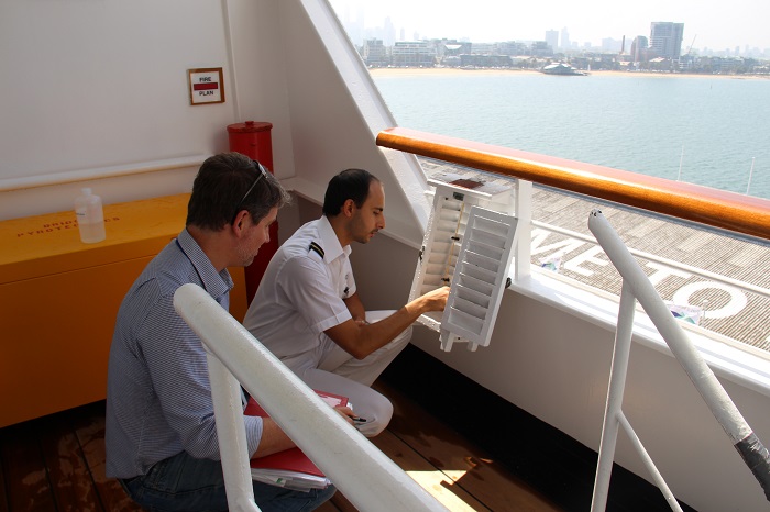
Image: The Port Meteorological Officer assists crew to maintain observation equipment aboard one of the ships in the Australian Voluntary Observing Fleet.
Helping ships provide accurate observations
To ensure that the weather observations provided by the volunteer ship network are accurate, our Port Meteorological Offices (located in Sydney, Fremantle and Melbourne) maintain contact with the ship masters and crew and routinely visit the ships to help calibrate and service the equipment.
One of the most important observations provided by ships is barometric pressure, or mean sea level pressure (MSLP). Ships observe this by using barometers. These need to be routinely calibrated to ensure accuracy.
In addition to the routine checks performed by Bureau staff, ships can also independently calibrate their barometers using the MSLP observations collected at automatic weather stations around Australia.
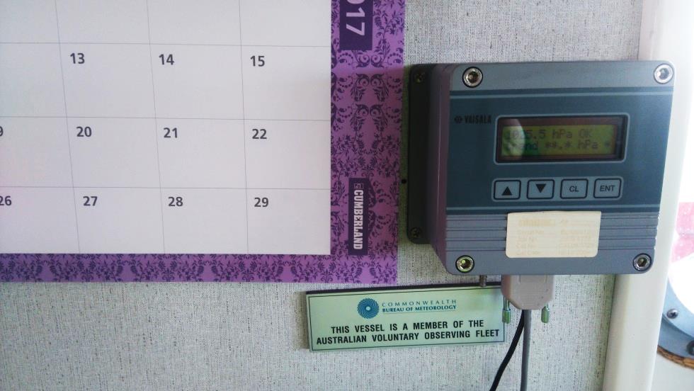
Image: A barometer recording mean sea level pressure.
More information
- Find out more about the Bureau's marine observations network and its part in the World Meteorological Organization's Voluntary Observing Ships scheme.
- Learn more about the contribution of Australia's maritime sector to the economy.
- We’re always looking for more ships to join the Australian Voluntary Observing Fleet—contact marine_obs@bom.gov.au.

Subscribe to this blog to receive an email alert when new articles are published.
Comment. Tell us what you think of this article.
Share. Tell others.