
Explainer: How does hail form?
24 May 2018
Whether it's peppering your window pane or battering your roof, hail can really make you sit up and take notice. But as well as creating an acoustic and visual spectacle, severe hailstorms have the potential to damage homes and cars, and cause life-threatening injuries. So how does hail form, and should you run for cover if it is forecast?
An icy reception
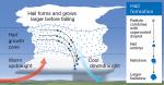
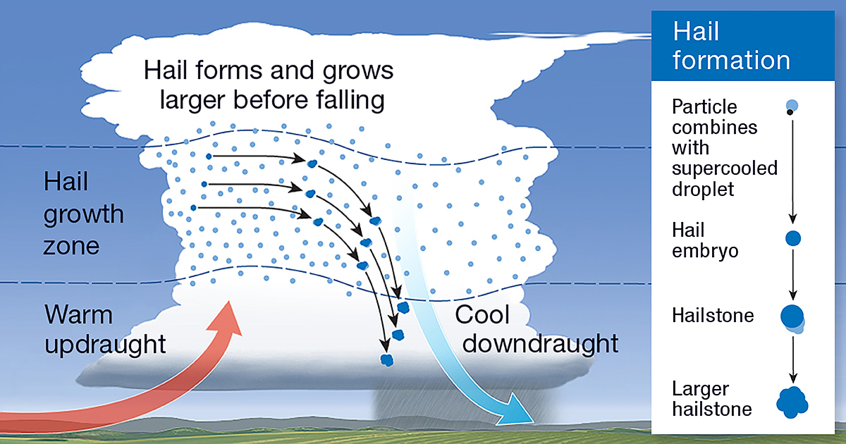
Hailstones are clumps of layered ice that form in updraughts, the rising air within thunderstorms.
Hailstones start as water vapour condensing into tiny water droplets that exist inside the updraught. Temperatures in the middle and upper parts of thunderstorm clouds can be very cold, even during the summer months. As the droplets are swept upwards into, or form inside, this very cold environment, they become 'super-cooled'. This means they're colder than 0 °C, but still liquid. They freeze into small ice balls (called 'hail embryos') if they come into contact with tiny particles in the air, such as a speck of dust or dirt, or a salt crystal.
Growth into a fully fledged hailstone happens in the 'hail growth zone', where the updraught air temperature is –10 to –25 °C. Here, hail embryos collide with super-cooled water droplets, causing them to freeze on impact. Once the hailstones have collided with enough of these droplets, building up in size, they become heavy enough to sink faster than the upward air motion that had previously suspended them. That's when they begin to fall.
Video: Dr Harald Richter's 30-second explanation of how hail forms
The size of a cricket ball
The size of the hailstones depends on the strength and size of the updraught. Most of the time hailstones are smaller than 25 mm in diameter—approximately the size of a 10 cent piece. However, in very intense thunderstorms, the upward air motion inside the updraught is so strong that even larger hailstones are suspended or fall very slowly. In these high-end storms, hailstones have more time to collect even more super-cooled water droplets and grow to larger sizes, such as golf-ball or cricket-ball size.
The most destructive hailstorm in Australian history occurred in Sydney’s inner and eastern suburbs on the evening of 14 April 1999, damaging thousands of homes and cars. Hailstones the size of cricket balls hit the city at more than 200 km/h. The storm hit 85 suburbs, causing damage to 20 000 houses, including windows, roofs and skylights. Seventy thousand cars sustained windscreen and panel damage. The worst affected areas included the southeast suburbs of Kensington, Kingsford, Botany, Mascot, Randwick and Paddington1.
When and where are hailstorms most likely in Australia?
Hail can occur at any time of year, but large hail is most common in Australia during spring and early summer. This is when temperatures at the surface are warm enough to promote the development of intense thunderstorms with strong updraughts and the upper atmosphere is still cool enough to support hail growth. In winter, showers and thunderstorms don't have the same strong updrafts as spring and early summer storms, so the hail tends to be smaller.
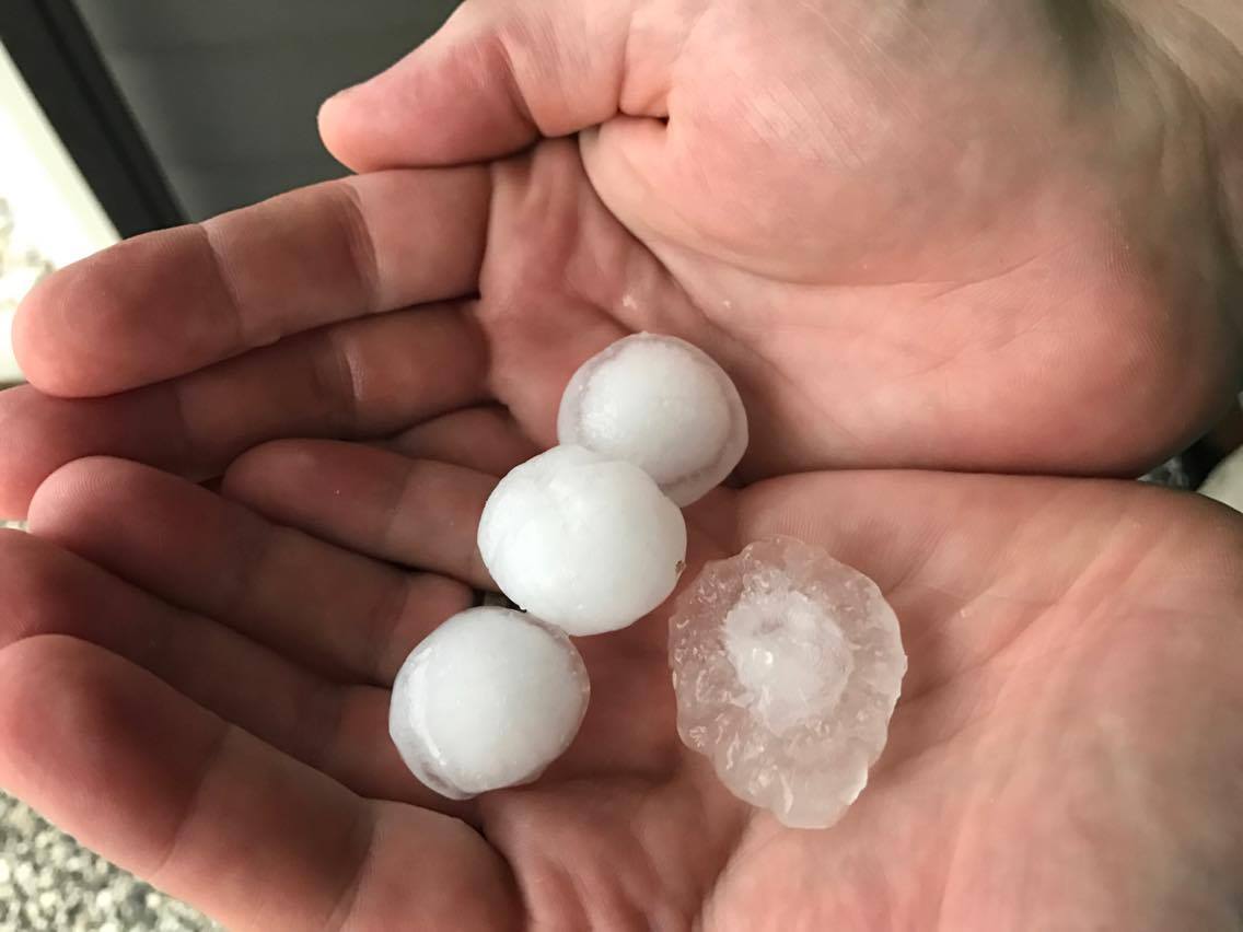
Image: Hail at Moggill, Queensland, on 8 November 2016. Credit: Andre de Wolf.
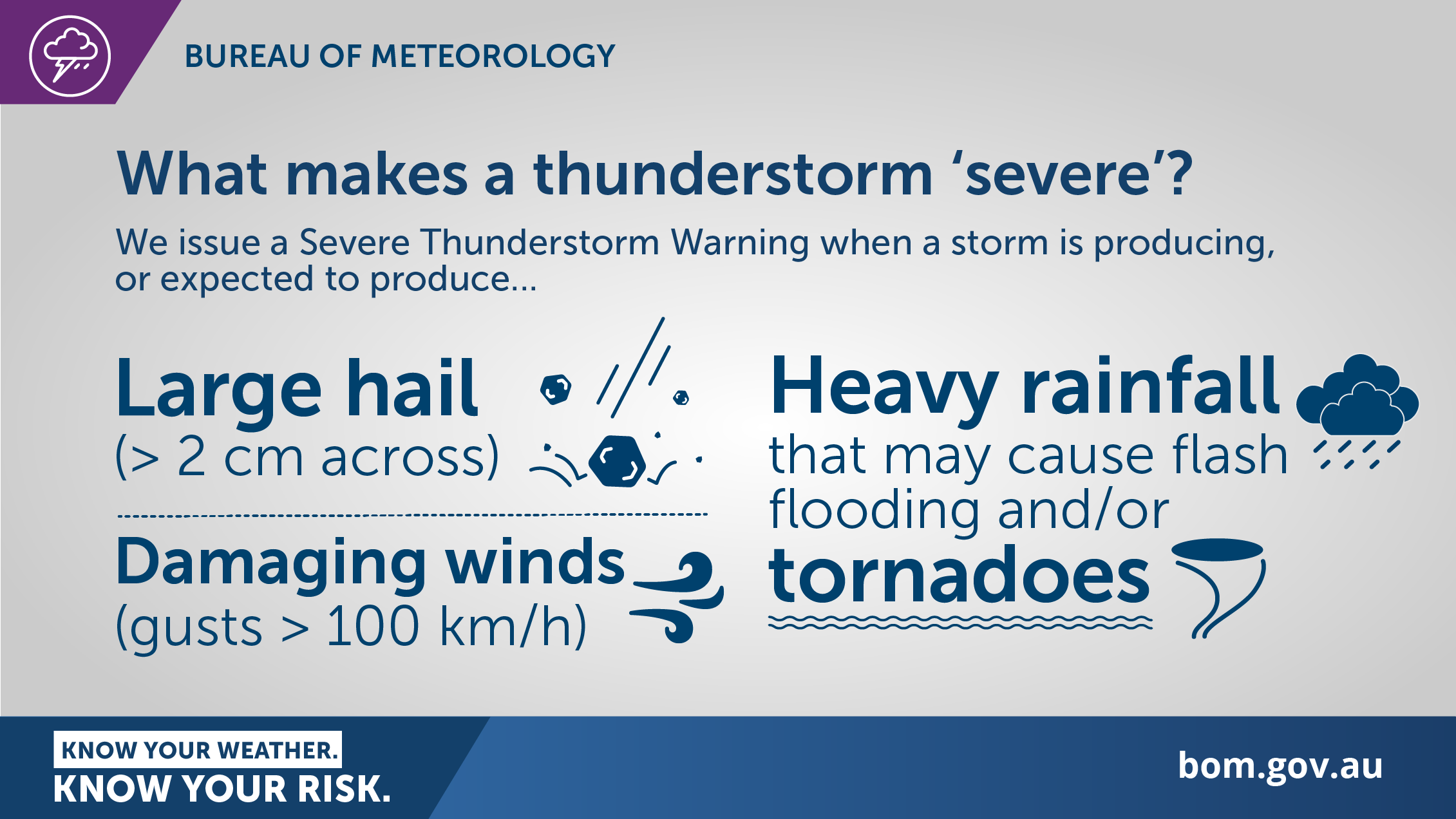
When does the Bureau issue warnings for hail?
The Bureau issues a Severe Thunderstorm Warning when thunderstorms are expected to produce one of the following:
- large hail with a diameter of at least 2 cm
- wind gusts of at least 90 km/h
- very heavy rain conducive to flash flooding
- tornadoes.
When hail larger than 5 cm across is expected, we add the words 'Giant Hail' to our warning. National and international studies have shown that hail of that size increases associated damage by several orders of magnitude – mostly because roof tiles start to break.
The location of severe thunderstorms is difficult to accurately predict well in advance. As a result, Severe Thunderstorm Warnings will generally have a lead time of no more than 3 hours.
When you hear a Severe Thunderstorm Warning broadcast for your area:
- take notice of the warning
- treat all thunderstorms that develop during this period with caution
- listen to the advice of emergency services.
During all thunderstorms, you should:
- move indoors away from windows, doors and skylights
- avoid using a landline telephone (lightning danger)
- avoid touching brick or concrete, or standing bare-footed on concrete or tiled floors
- take extreme care when driving.
If strong winds or hail are forecast, you should:
- put vehicles under cover
- beware of fallen trees and power lines.
Always keep an eye on the latest weather warnings.
More information
Preparation and safety during thunderstorms
Ask BOM: What is a thunderstorm?
Cooking up a storm—how thunderstorms form

Comment. Tell us what you think of this article.
Share. Tell others.