Planning a boating trip? Check the weather before you go!
20 December 2011
If you're preparing to head out on the water this summer, check the Bureau's round-the-clock forecast service for all Australian coastal waters.
Five vital checks
Video: watch this short video about the five vital checks.
There are five things to take note of when planning your boating trip: warnings, weather, wind, wave and tide conditions.
1. Warnings current for your boating area
Warnings are the highest priority forecasts. They warn of potentially dangerous wind conditions expected during the next 24 hours. Winds of 26 knots or more indicate rough conditions for small boats.
| Type of warning | Average wind speeds indicated |
|---|---|
| Strong wind | 26 to 33 knots |
| Gale | 34 to 47 knots |
| Storm force | 48 to 63 knots |
| Hurricane | 64 knots or more |
2. Weather conditions affecting safe navigation and comfort
Our coastal water forecasts provide information about conditions that may affect safe boating.
Take note of forecasts indicating reduced visibility from fog or rain, or risks to safety and comfort from thunderstorms, lightning or squall conditions.
Some forecasts will also include information on UV levels and the times of day to use sun protection.
It is also worth checking adjoining land forecasts as these provide more information about general weather conditions.
3. Wind conditions
To plan your trip for the best conditions, look for forecast trends in wind speeds and shifts in wind direction over the day. Forecast winds are average wind speeds, with gusts being up to 40 per cent stronger.
4. Wave conditions
Also take note of swell and sea wave conditions and how your boat reacts to short, sharp sea waves against longer and flatter, but more powerful, swell waves.
Swell waves don't enter enclosed waterways, but do have a dramatic effect on entrances to these areas.
Enclosed waterways are affected by sea waves – waves produced by the wind blowing across the region. A sea height of one metre can create enough chop to swamp a small boat. For coastal waters, you need to consider swell and sea waves. Swell waves can be of considerable danger near reefs and breakwaters.
The combination of sea and swell heights indicates the wave conditions you may experience. But you can't just add one to the other. For instance, a 2.5 metre swell and 2 metre seas results in wave conditions over 3.2 metres. See how to calculate combined sea and swell height.
5. Tide times
Knowing when high and low tide will occur is important for boats entering and exiting river entrances and crossing bars. The combination of an outgoing tidal flow or low tide can cause waves to become steeper than usual, making your boat difficult to navigate.
The changing tide over the day can cover rock platforms or reefs at high tide, whilst exposing them and creating a hazard at low tide.
Fishing on rock platforms may become dangerous at high tide as waves start to wash over or break onto the rock platform.
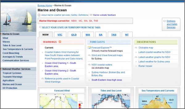
The national Marine and Ocean page contains all forecast and warning information for your state. (Click on image to visit page.)

Marine Forecast Explorer™ displays graphical forecasts and seven-day forecasts for any point (currently only available for NSW, Victoria and Tasmania).
Getting forecasts while you're out on the water
You can access our marine website using 3G mobile coverage if you're close to the coast. Forecasts are also provided by VHF and HF radio broadcasts. See our Marine & Ocean Communication Services page for more information.
More Information
See our Marine & Ocean Check the weather before you go out on the water page for more information.
Happy boating from the Bureau of Meteorology!
Article URLs
- Bureau of Meteorology – Marine and Ocean Services
- Bureau of Meteorology – Check the weather before you go out on the water
- Marine Forecast Explorer™ for New South Wales, Victoria and Tasmania.


Comment. Tell us what you think of this article.
Share. Tell others.