Rain has eased the dry, but more is needed to break the drought
18 February 2020
After the intensely dry conditions of 2019, January and February have brought much-needed rain. Dams in many cities and towns were replenished and some farmers may be able to grow a crop for the first time in several seasons. So does this mean the drought has broken?
The answer is not straightforward. There is no single definition of drought, and the impact of rain varies enormously depending on where it falls.
The assessment of drought conditions involves not just rainfall, but other factors such as water supplies and soil moisture.
The Bureau of Meteorology reports on “meteorological drought” – that is, drought considered purely from the perspective of rainfall deficits. Totals in the lowest 10% of historical observations are considered a serious to severe rainfall deficiency. The Bureau does not have responsibility for declaring drought, which is complex and reflects both demand and supply of water, as well as social and economic factors.
In the three years to January 2020 some 33% of Australia and 96% of New South Wales had serious or severe rainfall deficiencies. In the most-affected regions, rainfall over the past three years was around half the long-term average.
Based on rainfall so far in February, the areas suffering serious to severe deficiencies has only slightly improved (to around 30% of Australia and 90% of New South Wales).
In other words, while some areas have seen excellent rainfall, others have not—so the overall relief from meteorological drought so far this year is modest.
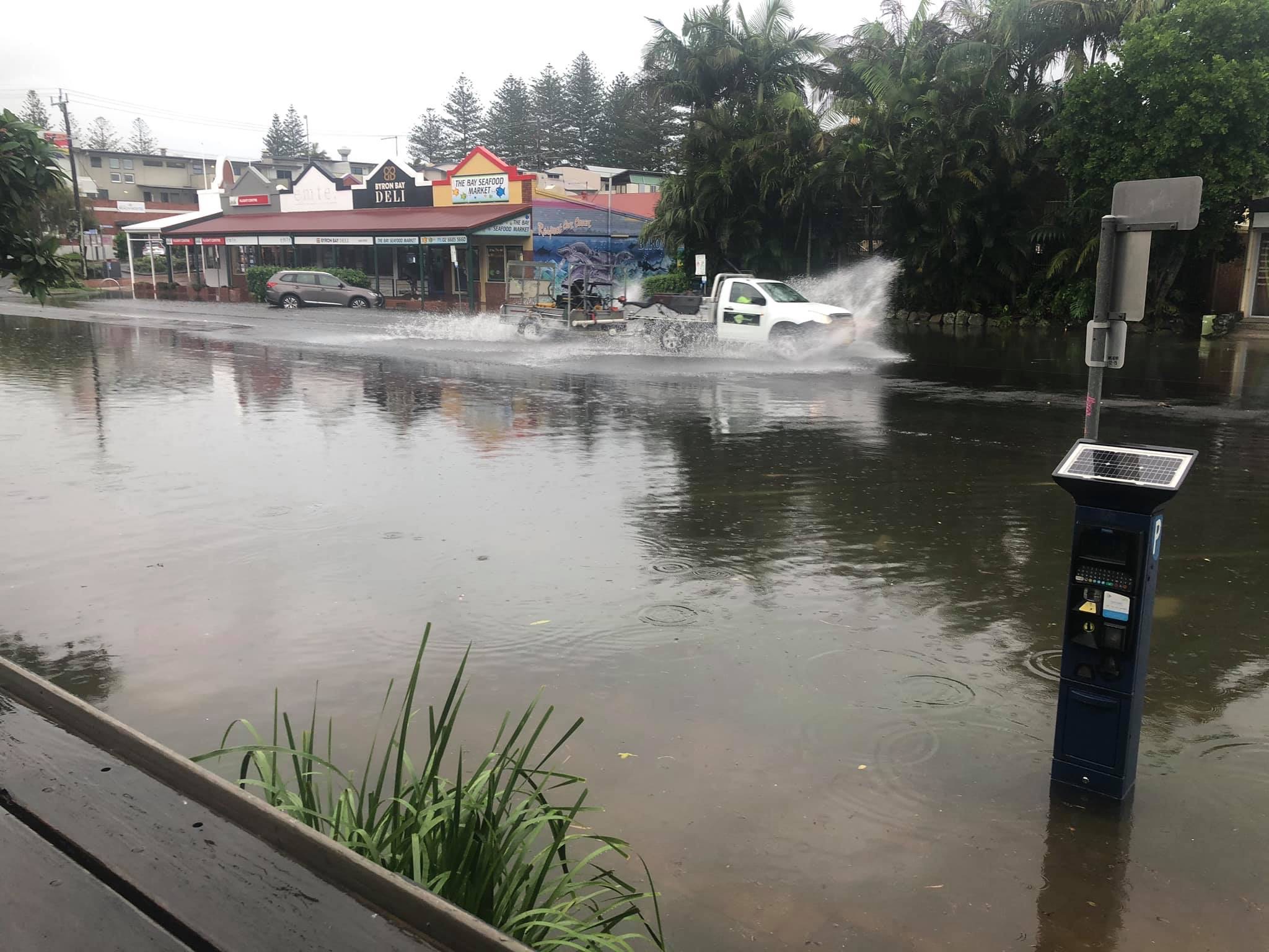
Image: flooding at Byron Bay, New South Wales, February 2020. Credit: Seapics by Dave Bryant.
The big dry
To understand the impact of the recent rain, we need to understand the extent of the drought gripping much of the continent.
Last year was Australia’s driest on record, intensifying one of the most severe droughts of the past century.
In eastern Australia, the dry contributed to the severe 2019–20 fire season. It also challenged town water supplies, and contributed to mass fish die-offs, falls in agricultural production and drying wetlands.
The dry conditions were intense and persistent. The Murray–Darling Basin experienced above-average rainfall in just five months from 2017 to 2019. The total three-year rainfall was a record low 917mm—that’s 548mm below average.
Dry conditions have also affected all east coast urban regions south of Townsville, including Brisbane, Sydney, Canberra and Melbourne.

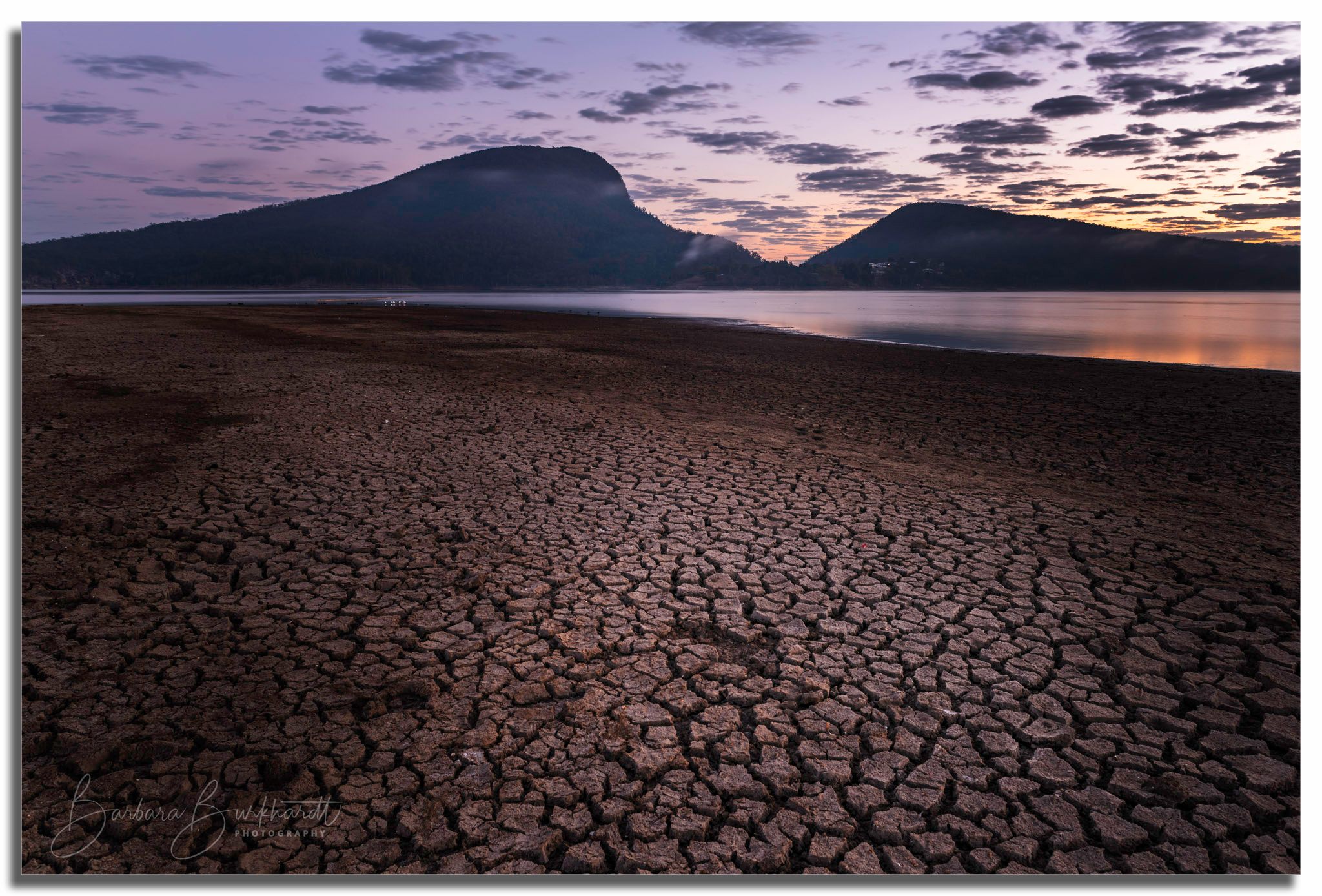
Image: Moogerah Dam, Queensland. Credit: Barbara Burkhardt Landscape Photography.
Then the rains came
Rainfall associated with low pressure systems affected Victoria, northeast NSW and inland Queensland in January. Monsoon conditions, coupled with tropical cyclones Claudia and Damien, also marked the late onset of wet season rainfall for tropical areas.
The national rainfall for January was slightly above average (89mm), though NSW, South Australia and the Murray–Darling Basin again recorded below average rainfall overall.
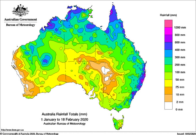
The first half of February has seen good rain across South Australia and inland Western Australia, and heavy rainfall along the east coast (seaward of the Great Dividing Range).
Rainfall was heavy around Sydney, the Illawarra and northeast NSW/southeast Queensland. Several local rainfall records were broken, while Sydney saw a remarkable 392mm fall over four days—more than the city received in the second half of 2019.
But the rain did not fall evenly across the eastern States. Many places in southern and western NSW have received only patchy falls. For example, Broken Hill has received just 8mm since the start of the year. These areas will need more rain to ease drought conditions.

Map: Rainfall totals 1 January to 18 February 2020.
More than rain
Drought is not just about rainfall but also about the water available in dams, in the soil and in our groundwater systems.
At the end of 2019, soil moisture reserves across large parts of the country were close to zero. In recent weeks, absolute soil moisture across Queensland, NSW, South Australia and Victoria has improved.
While the east coast is now generally very wet, conditions are more varied inland reflecting the patchy nature of summer storms.
Map: soil moisture 31 December 2019. Credit: Bureau of Meteorology.
Maps: soil moisture 16 February 2020. Credit: Bureau of Meteorology.
Inland rain led to local flash-flooding and triggered high river flows in several areas. Previously dry stretches of the Condamine River in Queensland have flooded, and the Namoi and Castlereagh Rivers in NSW have had their first flows in many months.
A small volume of water will likely make it down the Darling, it will take more than a month. This is because losses to evaporation and seepage into the riverbed will be high.
But not enough rain has fallen in the right places to significantly impact dam levels in northern NSW, which have been critically low over the past year.
Collectively, storage volumes in major dams in the northern Murray–Darling Basin have only increased by around 5%. The heaviest inland rain was downstream on the plains rather than on the western slopes of the Great Dividing Range, which feed the dams.
There have, however, been notable increases in dam levels along the east coast where the best rain fell. Since the start of February, water storage volumes have increased from 42% to 79% in the Greater Sydney region and from 56% to 67% in southeast Queensland.
.png)
 - LEGEND 2.png)
 - LEGEND 1.png)
Map: runoff and water storage levels, 16 February 2020. Credit: Bureau of Meteorology.
Rain in the season ahead
Some areas have seen heavy rainfall which has brought drought relief. But others will need more rain in coming months to ease drought conditions.
A natural climate driver, known as the Indian Ocean Dipole, fuelled very dry conditions in Australia in the second half of 2019. That event has now finished, and climate drivers are expected to remain “neutral” in the coming months. This means they are not expected to strongly influence our weather and climate.

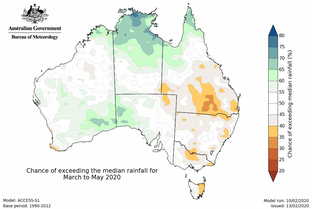
Map: Rainfall outlook for autumn 2020. Credit: Bureau of Meteorology.
The autumn 2020 rainfall outlook shows a mixed picture. In the northern and inland western areas of the continent above-median rainfall is favoured.
Elsewhere, the probability of above-median rainfall is near or below 50%. This suggests drought relief may be slow and patchy overall.
More information
You can find climate outlooks and rainfall information here. Find out more about soil moisture and water storages.
Sign up to climate and water information emails.
![]()
This article is republished from The Conversation under a Creative Commons license. Read the original article.


.PNG)
.PNG)

Comment. Tell us what you think of this article.
Share. Tell others.