
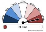
What is El Niño?
22 September 2023
During El Niño, eastern Australia has more chance of drier and warmer weather. It is one phase of a natural cycle called the El Niño–Southern Oscillation. So, what causes it and what does El Niño mean for Australia?
What is El Niño?
El Niño is one phase of a natural climate cycle called the El Niño–Southern Oscillation (ENSO). ENSO describes changes in the tropical Pacific Ocean that affect global weather.
This includes ocean temperatures and the strength of trade winds in the Pacific.
ENSO phases
ENSO moves between 3 phases connected to sea surface temperature changes in the eastern and central tropical Pacific:
- El Niño – the warm phase
- Neutral – close to normal; usual climate and weather changes
- La Niña – the cool phase.
Video: Watch a video about El Niño and La Niña (4 minutes).
What happens during El Niño?
During El Niño:
- waters are warmer than usual in the central and eastern tropical Pacific Ocean
- trade winds are weaker than usual
- clouds and rain shift further east in the Pacific, away from Australia.
What influence does El Niño have on Australia?
El Niño occurs, on average, every 3 to 5 years. Each El Niño is slightly different, and its impact can vary depending on where you are, and from event-to-event.
Changes we may see during El Niño include:
- reduced rainfall for eastern Australia
- warmer daytime temperatures for the southern two-thirds of Australia
- increased risk of extreme heat
- increased fire danger in south-eastern Australia
- increased frost risk linked to clear night skies
- decreased alpine snow depths
- later start to the northern rainfall onset – the first significant rain after the dry season
- reduced tropical cyclone numbers.
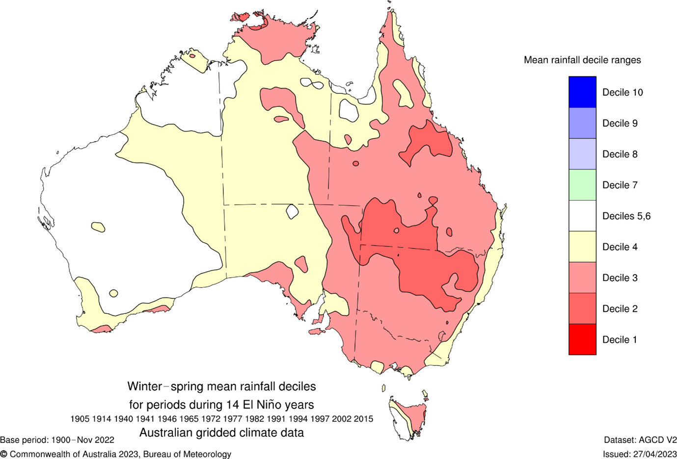
Map: Australia's winter–spring rainfall averaged over 14 El Niño years that were moderate or strong. Decile 1 = lowest 10% rainfall on record; Decile 2 = rainfall values between the lowest 10–20% on record and so on, compared to rainfall records between 1900 and 2022.
What makes an El Niño event strong or weak?
Indicators of El Niño strength include:
- higher sea surface temperatures and sub-surface temperatures in different parts of the Pacific Ocean
- sustained weaker than average trade winds, or even a reversal of trade winds, over the eastern tropical Pacific Ocean
- increased cloudiness around the equator near the International Date Line
- sustained negative values of the Southern Oscillation Index – which measures changes in the overlying atmospheric circulation patterns.
The strength of an El Niño event (as measured by the indicators above) does not always translate to the strength of its effect in Australia.
Australia has had strong events with a weak effect on our rainfall, and weak events with strong rainfall effects. For example, 1997 was a strong event with below average rainfall in some areas only; 2002 was a weaker event with below average rainfall for almost all of Australia.

Graphic: Signs of an El Niño forming.
When does the Bureau announce the onset of El Niño?
There are several climate indicators that need to pass thresholds for the Bureau to consider an El Niño is underway in the tropical Pacific.
Our climatologists track conditions in the atmosphere and ocean across the Pacific, and refer to expected conditions in the months ahead from several global climate models.
We announce a change in the ENSO Outlook when we have observed a trend over several weeks to months.
More details are in the ENSO Outlook on our website.
Does El Niño mean drought for Australia?
El Niño is one indicator of a potential change in rainfall and temperature patterns, but it is not the only impact on Australia's long-range forecast.
An El Niño event does not always coincide with drought in Australia.
Around two-thirds of Australia's 10 driest years on record were during El Niño.
Impact on long-range forecasts
Our long-range forecasts predict temperature and rainfall up to 3 months ahead. The onset of El Niño does not change these forecasts – it simply confirms what we already know about the ocean and atmospheric conditions in the Pacific.
Forecasts are usually less accurate at 4 months ahead or longer. However, we can predict sea surface temperatures in the tropical Pacific between 6 and 9 months ahead. This can show likely conditions beyond the 3-month official rainfall and temperature forecast.
Information on climate drivers like El Niño also helps us predict the likely impacts for the Australian region based on what has happened in the past.
More information
- El Niño declared 19 September 2023
- ENSO, El Niño and La Niña
- How El Niño impacts Australia
- A history of rainfall during El Niño years
- Long-range forecast
- Latest Climate Driver Update
- Subscribe to receive climate information by email.

Comment. Tell us what you think of this article.
Share. Tell others.