
Know your weather warnings
10 September 2024
Severe weather can develop quickly and threaten lives and property. You can reduce its impact by getting ready before it happens. Our regular forecasts and warnings help you to stay aware of what's on the way. So which warnings can you expect to see for some of Australia's highest-impact weather?
We issue warnings when weather conditions have the potential to threaten lives and property. But different weather calls for different warnings. The information warnings contain and how far in advance of the weather they're issued vary. It's important to read warnings carefully to make sure you understand them and get the most out of what's in them.
During any dangerous weather situation, follow the advice of your local emergency services.
How to access warnings
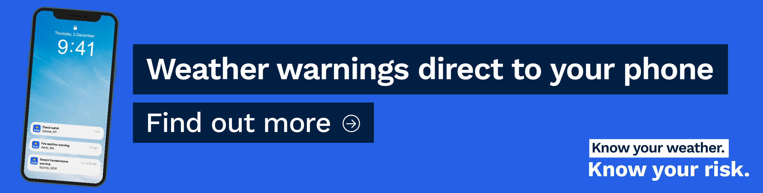
You can find the latest warnings on our website or the BOM Weather app. One of the easiest ways to stay on top of them is to set up notifications on your app. That way you'll receive warnings for areas and weather types you choose, direct to your device.
Fire weather warnings
Weather has a big influence on fires. It can affect their size and intensity, how quickly they spread – and how dangerous they are to the community.
Fire risk is calculated by looking at weather and fuel conditions, such as how much vegetation there is to burn. It's communicated through fire danger ratings – moderate, high, extreme or catastrophic. We work with state and territory fire agencies, who set these ratings.
When the fire danger rating is extreme or catastrophic, we issue a Fire Weather Warning. The warning includes information about forecast weather conditions and advice from emergency services.
Fire weather warnings are issued:
- early in the morning for the current day
- in the afternoon for the following day.
Learn more about fire weather.
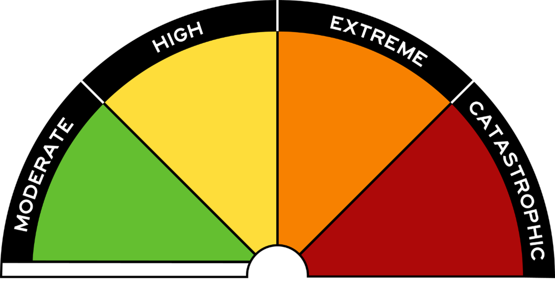
Image: Australian fire danger rating scale
Flood watches and warnings
Flooding is among Australia's most deadly natural disasters. But it's also important for the life cycles of many plants and animals, and for agriculture.
We issue warnings about riverine flood. This is where rivers break their banks and water covers the surrounding land. It's mostly caused by heavy rain, which can enter the river system a long way upstream. It can cover large areas and last for months in some regions.
We provide 2 kinds of flood advice – watches and warnings.
We issue a Flood Watch when forecast rain suggests that flood is possible. It provides early advice of a developing situation that may lead to flooding. It's not a warning of imminent flooding. It contains links to weather warnings, other flood-related information and contact details for emergency services. It can be issued up to 4 days in advance of expected flooding.
We issue a Flood Warning when we're more certain that flooding will happen at a particular location. Warnings include the expected severity of the flood and predictions about the level the river will rise to. If the data to make predictions that specific isn't available, the information is more general.
Learn more about flood.
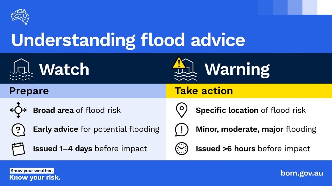
Image: Understanding flood watches and flood warnings
Severe thunderstorm warnings
While we experience many types of thunderstorms in Australia, some more intense ones are considered severe.
A thunderstorm is classified as severe if it produces any of the following:
- large hail – 2 cm in diameter or larger
- damaging wind gusts – 90 km/h or greater
- tornadoes
- heavy rain that may lead to flash flooding.
We issue a Severe Thunderstorm Warning when:
- a severe thunderstorm is occurring, likely to occur or is reported
- phenomena listed above are expected in the warning area
- existing thunderstorms are likely to develop into a severe thunderstorm.
Severe thunderstorms can be quite localised and can develop, evolve and disappear quickly. The exact location can be hard to predict, even with short lead times.
There are 2 types of severe thunderstorm warning, detailed and regional. Both types show the warning area on a map.
- Regional warnings cover broad areas and show where severe thunderstorms are or may be in the next 3 hours.
- Detailed warnings also give time and location-specific information about the threat.
Learn more about severe thunderstorms.
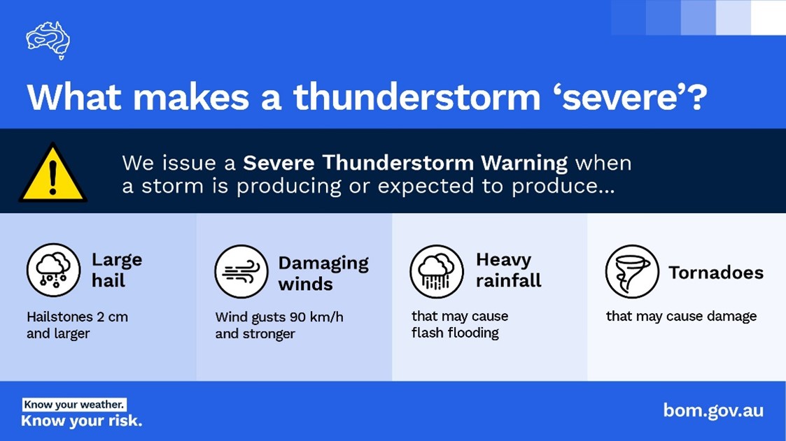
Image: What makes a thunderstorm severe
Heatwave warnings
Severe and extreme heatwaves have claimed more lives than any other natural hazard in Australia.
We classify heatwaves by intensity – low, severe or extreme. We issue heatwave warnings when severe or extreme heatwaves are expected.
A heatwave warning consists of 4 maps covering 4 three-day periods, extending out to 3 days in the future. The warning includes:
- expected maximum and minimum temperatures
- when the heatwave will peak and/or ease
- a list of affected towns and communities within the warning area
- action statements agreed with health and emergency service agencies across Australia.
We issue the warnings at 3 pm in all states and territories except Western Australia, which receives theirs at 2 pm.
Learn more about heatwaves.
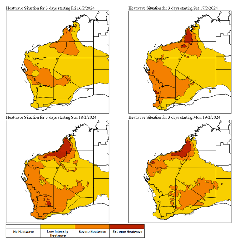
Image: Example heatwave warning maps
Tropical cyclone watches and warnings
Tropical cyclones are violent, spiralling wind and rain systems that threaten lives and property. They can cause disruption, damage and destruction far beyond the coast.
Alerting you about cyclones takes the form of watches and warnings, depending how long it is before the gales start to affect the coast:
- when gales are expected to start within 24 to 48 hours, we issue a Tropical Cyclone Watch, updating it every 6 hours
- when gales are expected within 24 hours or already happening, we issue a Tropical Cyclone Warning every 3 hours.
Both forms of advice contain a tropical cyclone forecast track map. The map shows:
- forecast movement – a shaded area indicates where the cyclone centre may move
- intensity
- watch or warning zones.
Learn more about tropical cyclones.
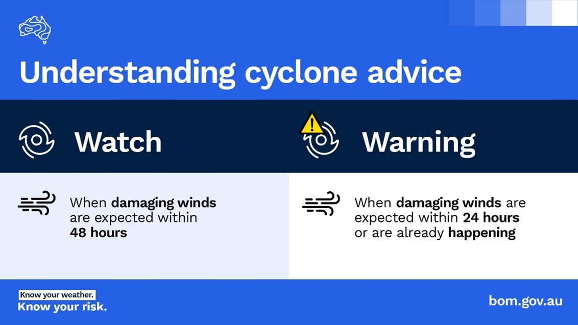
Image: Understanding cyclone watches and warnings
More information
As well as the warnings covered above, the Bureau issues other warnings. These include warnings for coastal hazards, marine wind, severe weather and tsunami. You can view all current warnings on our website and app.

Comment. Tell us what you think of this article.
Share. Tell others.