What does it take to build a weather radar?
07 November 2024
Building a new weather radar may seem as simple as finding a hill, pouring concrete and erecting a tower. But it's more complicated than you might think. Let's dig into some of the challenges.
What is a weather radar?
A radar is observation equipment that allows us to see precipitation, such as rain or hail. You can see the pictures on our website or the BOM Weather app.
The Bureau is responsible for 69 radars. They're part of a comprehensive weather observation network of more than 11,000 pieces of equipment.
Find out how radars work.
Radar builds are complex
People often ask us why it takes a long time to install a radar.
Typically, it takes around 18 months from when groundworks start until a new radar begins full operation.
Building radars presents complex scheduling challenges. We must take into account factors such as severe weather, specific site challenges, transport and logistics, and the availability of equipment.
Finding the right location
Once the decision has been made to build a radar in a certain area, the most complex part of the project is finding the right site.
Radars are usually located in big open spaces, so that buildings and mountains don't get in the way of coverage.
To determine the best position for the radar, we consider factors such as:
- current and future lines of sight
- obstructions from trees, communication towers, terrain and buildings
- preventing radiation hazard to the community
- access to power and data communications
- access to Bureau operational and maintenance teams
- other local concerns, including land ownership, flooding history, environmental considerations, native title and cultural heritage.

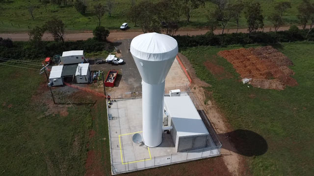
Image: A cover keeps rain out of the tower during construction of the Toowoomba radar in Queensland.
We do a lot of work to identify the one or 2 best locations for the radar. Our next steps include:
- working through land use agreements
- engaging with traditional owners and local councils
- completing cultural heritage and environmental surveys.
Examples of how we've addressed issues raised include:
- fencing off sacred sites so construction didn't affect areas of cultural significance at the Greenvale radar in Queensland
- tying pink ribbons around hundreds of native macadamia trees so they were easily identifiable and could be avoided by machinery at the Mt Staplyton radar in Queensland
- diverting an access road around nesting eagles at the Mt Koonya radar in Tasmania.
Getting the radar to the site
It can take up to 18 months to receive the radar from our supplier. Once it’s ready, it needs to get to the site, which isn't always easy.
- Flooded roads in 2023 meant the only way to get the radar to Gove in the Northern Territory was by barge. With fresh water and food being priorities, getting a place on the barge took careful negotiation.
- The Karratha radar in north-west Western Australia travelled 2000 km from Gladstone, Queensland. Again, flooded roads proved a challenge. This time they forced a detour via South Australia that added 2 days to the journey.
Challenging terrain on site
Radar sites must be elevated to reduce interference from any obstacles, such as mountains, trees or buildings. This means site access can be difficult.
For example, the Karratha radar needed a giant remote-controlled truck to transport the tower segments to the installation site on Radio Hill.
Video: Watch a remote-controlled truck carry radar parts to the installation site near Karratha in Western Australia.
The site location there was a challenge in itself. It was 40 km south of Karratha in the remote far north-west of Western Australia. And there were plenty of other challenges at Radio Hill:
- a steep unsealed access road with 26% gradient sections
- rock had to be sawn, drilled, broken by a rock breaker and removed to create the tower base
- transporting 300 cubic metres of concrete up the steep track meant special concrete agitators were needed
- roadworks were needed at the top of the hill, to create space to manoeuvre and for the 150-tonne crane and tower segments.
And Karratha isn't the only site which presented challenges.
At the Marburg radar near Brisbane, the steep, unsealed road called for a convoy of 3 heavy trucks to get the new radar tower to the top.
The Yeoval radar is near the famous 'Dish' radio telescope at Parkes, New South Wales. Before building it, radio telescope scientists, the radar supplier and our radar engineering experts completed an interference analysis. This was to make sure the extremely sensitive telescope would still receive weak electromagnetic signals from space. Radio signals from a nearby radar could have affected how the telescope worked or even made it 'blind' to deep space observations.

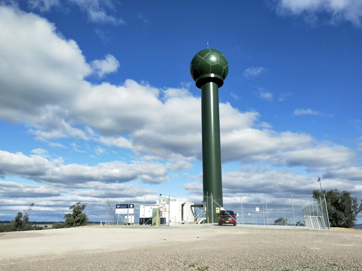
Image: Most radars are white but the unique green radar at Yeoval was painted at landholder request to better blend into the surrounding forest landscape.
Testing the radar
Once the physical construction of the radar is visible, we often get questions from the community and the media about why they can't see the images.
There's a testing process before the images go live. First the radar supplier runs tests remotely. Then our teams conduct detailed testing to make sure the radar hardware is running correctly. They also assess the quality and performance of the data.
Radar data feeds into forecast models, and is used by government, industry and the public. It's important that the images are accurate and meet quality standards before we release them.


Comment. Tell us what you think of this article.
Share. Tell others.