
Three steps to Australia’s best weather forecasts
23 July 2014
Behind the scenes of your morning forecast is a long process of observation, modelling and predictive analysis – involving the country’s finest weather forecasters, and some very clever machines.
Have you ever got up in the morning and wondered what to wear? Couldn’t decide if you should spray the orchard or go out fishing? Most people check the weather forecast at some point during the day, without even thinking how it was created. For some people – farmers, transporters, outdoor events organisers – receiving an accurate forecast can be absolutely critical.
At the Bureau of Meteorology, a team of dedicated people is working around the clock to create your morning forecast and ensure that it is as accurate as possible. Here is how they do it.
Watching the weather
Observations are an essential part of the forecasting process. They allow us to see what is happening right now and to track changing conditions. Is that rain band producing significant rainfall? Is the temperature really 45 degrees in Adelaide?
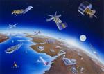
There are many different ways that we get our observations. We operate more than 600 automatic weather stations across Australia, including several located on offshore reefs and islands. These stations feed us a continuous stream of data, with information on the temperature, air pressure, wind, rainfall and humidity updated as often as every minute.
In some locations we have high-tech weather balloons which measure the temperature and wind speed as they rise. We have radar for telling us where and how heavy the rain is. We also receive continuous data streams from two of the region’s most advanced weather satellite networks: Japan’s MTSAT satellites and China’s Feng Yun-2 network, which provide a broad picture of the weather over Australia and the eastern Indian Ocean.
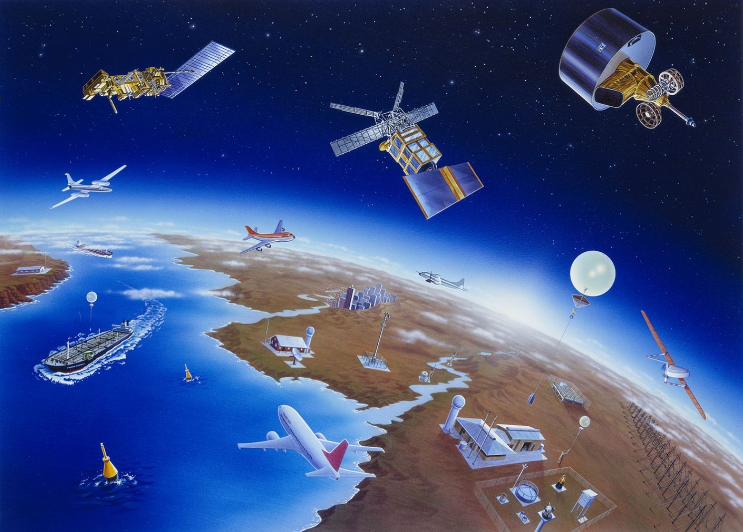
Ships and aircraft help us take weather observations from remote areas of the ocean and upper atmosphere. While satellites can collect some observations across large areas, it is still important to take observations at designated locations.
Looking into the future
Observations may help us study what is happening right now, but we need the help of some ingenious computer models to look into the future. These numerical models take a snapshot of the atmosphere at a given time and then run a series of complex mathematical equations, or algorithms, to predict changes to the atmosphere over the coming hours and days.
In a simple sense, modelling is like knowing the speed of a car and using it to estimate where the car will travel to in the future. Of course, the atmosphere is much more complicated than a travelling car – and our models often come up with different weather outcomes based on different rates of change. This is why it requires some very diligent and highly-trained meteorologists to decide which of the models’ findings are likely to eventuate.
Creating the forecast
When we know what is happening now and what several models think is going to happen in the future, it is time to make a prediction. We do this using our Next Generation Forecast and Warning System, or NexGen FWS, which enables our forecasters to produce comprehensive forecasts on 6km grid squares covering Australia for the week ahead.
Using their specific knowledge of local conditions and evolving weather patterns, forecasters adjust and ‘fill in’ the broader-scale information provided by the models to produce a detailed forecast for the days ahead. In recent times, our forecasters have also been developing a number of ‘smart tools’ to improve our forecasting of elements with distinctive behaviour – such as sea breezes and the effects of mountains on wind and rain.

A meteorologist analyses the weather observations, while another meteorologist produces the forecast grids for the next 7 days.
Finally… the weather
Is there a sea breeze? Where is the fog likely? How much rainfall can be expected in those showers? All these answers have been produced by the Bureau’s forecasters and can be viewed from our website through specific text forecasts, or in our MetEye map display system. All those lines, colours and numbers will have been handpicked and moved around by a forecaster – to help you decide what to wear, or whether a farmer could spray their orchard, or whether it will be a good day for fishing.
Comment. Tell us what you think of this article.
Share. Tell others.