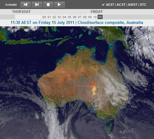
A view from the top: new Satellite Image Viewer launched
19 July 2011
The satellite pages on the Bureau's site have been among our most popular, particularly in the last year. Our satellite images have given us a unique view of 12 months of extraordinary weather events – persistent cloudy conditions, flooding rains and spectacular tropical cyclones.
Hourly satellite images showed tropical cyclone Yasi looming as a phenomenal mass of cloud over the Pacific Ocean as it moved towards the Queensland coastline. We could visualise the size and scale of the system and monitor its direction and speed. These satellite images provided useful information for forecasters, emergency services and the community.

To paint a picture of Yasi's evolution, we animated a special collection of images of the event. We used this to guide a redevelopment project, and now we've launched the new and improved Satellite Image Viewer.
Better features, more images and information
Our Satellite Image Viewer will show 24 images for the Australian region at one-hour intervals. You'll be able to:
- watch an animation or step through the images;
- choose from a range of images: coloured cloud, topography, infrared, visible images and false colour enhancements (showing temperature differences);
- display a time zone such as Australian Eastern Standard Time or use Coordinated Universal Time (UTC);
- access our Satellite Notes – a description of the recent atmospheric conditions with a focus on cloud cover;
- read more about each type of image and how we source them; and
- follow links to significant events and related information.
Article URLs
Try out the new Satellite Image Viewer


Comment. Tell us what you think of this article.
Share. Tell others.