

Snow alert: How to make sure you stay on top of the snow this ski season
03 June 2015
Updated 7 June 2017
Heading for the ski fields this winter? You’ll be much better prepared if you take the Bureau’s snow forecasts along with you on your laptop, tablet or smartphone.
Tech-savvy skiers watch out—Australia’s most accurate weather forecasts are now available at your fingertips via our map-based MetEye tool and the BOM Weather app. Make sure you don't miss a drop of the white stuff!
Planning your skiing trip
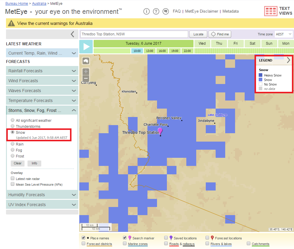
If you’re using a PC, MetEye will show you where snow is forecast at a specific location over three-hour intervals during the next seven days.
From the MetEye landing page, go to the section for forecasts of Storms, Snow, Rain, Fog and Frost, and select ‘Snow’. Type in your preferred resort or location of interest in the location box at the top of the map—for example, Falls Creek or Thredbo Top Station—and select from the list. You can also type in longitude and latitude to see forecasts for remote backcountry areas.
You’ll see the image below, with areas shaded according to the highlighted legend with the level of snow expected at the chosen time step.
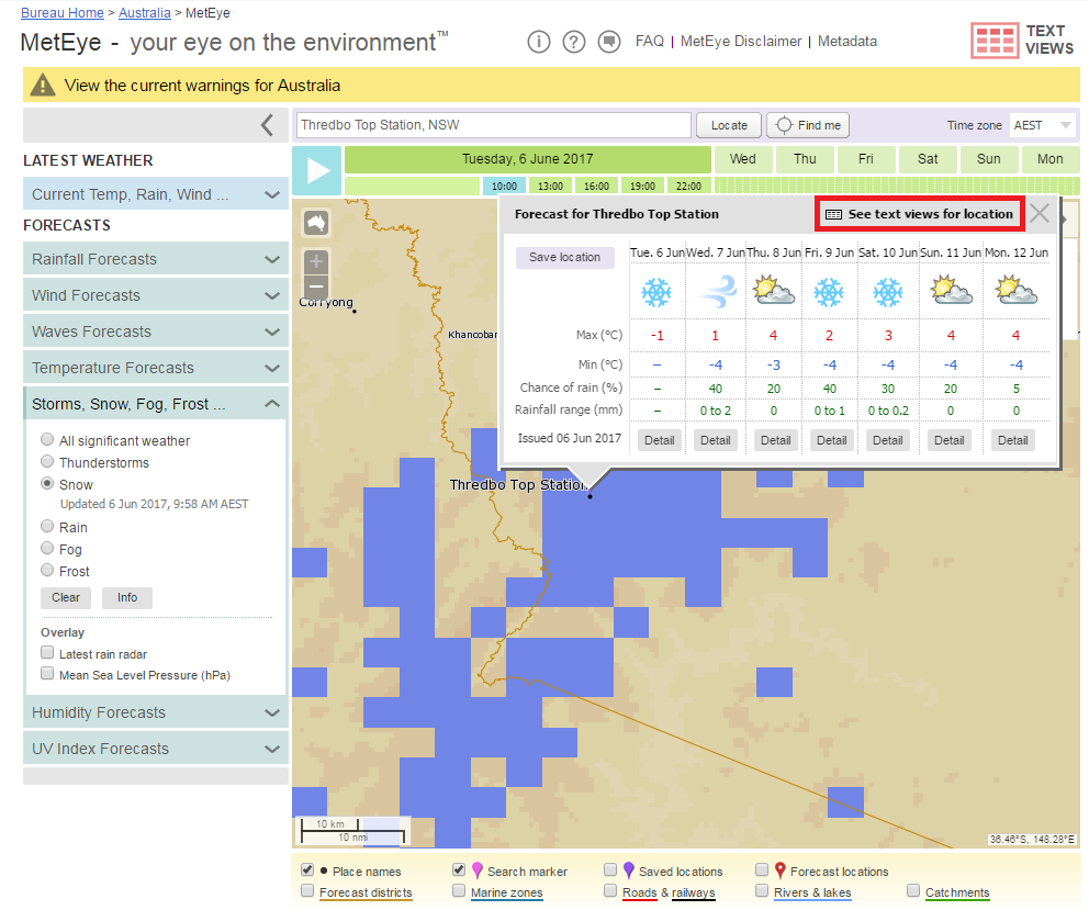
A pop-up window with the forecast for the next seven days will also appear, looking like the image below. Inside this window is a link to ‘See text views for location’ (highlighted in red), which will take you to a much more detailed view that includes current conditions from the closest weather station, and three-hourly and daily forecasts.
The next screen will look like the image below, with daily forecasts for the next seven days.
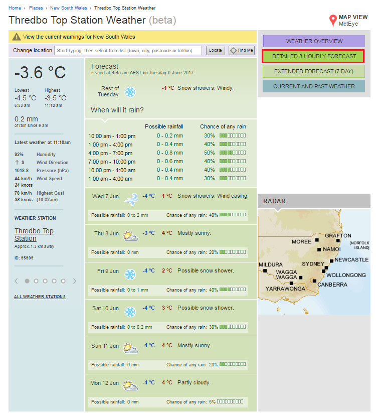
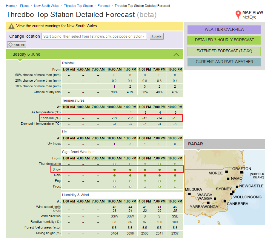
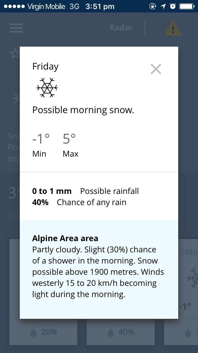
Again in the top right-hand corner, there is a link to the ‘Detailed 3-hourly forecast’ (highlighted). This will take you to the full weather breakdown (see below), which includes apparent temperature (what it ‘Feels like’, highlighted), and the chance of rain, snow (highlighted), fog and other weather phemomena.
Information at your fingertips
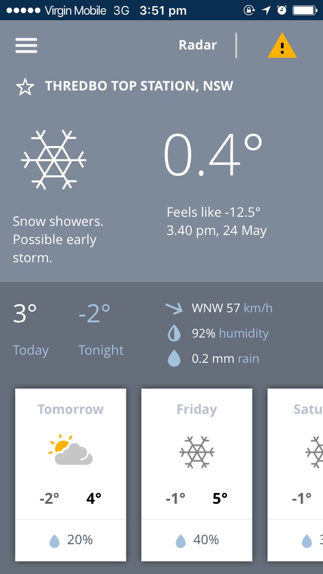
Wherever you are, snow forecasts are easy to access with the BOM Weather app. The app provides forecasts for all of Australia’s major skiing areas—not just towns and resorts—and puts important weather warnings and observations in easy reach.
The app gives you an instant ‘picture’ of how the weather will develop over the week ahead through at-a-glance daily icons (including a snow icon) and the major weather parameters. It also shows you the 'Chance of any rain’ which can translate to snow in the right conditions. As a rough guide, 1 mm of rain is equivalent to 1 cm of snow.
The app also shows you current conditions including observations of temperature, apparent ('Feels like') temperature and rainfall. An easy scroll down will show you the rainfall radar.
Remember that:
- outdoor activities in alpine regions are very susceptible to the weather—use caution all year round;
- always check the weather forecast before you go out; and
- keep a watch on the weather while you're out as conditions can deteriorate quickly.
Happy skiing and snowboarding!

Subscribe to this blog to receive an email alert when new articles are published.
Comment. Tell us what you think of this article.
Share. Tell others.