
How does Australia’s tsunami warning system work?
08 September 2016
Australia is in a very stable location, in the middle of a continental plate and away from major fault lines, but we are very close to the Pacific ‘Ring of Fire’—the source of 75 per cent of the world’s volcanoes and 80 per cent of its major earthquakes. Tsunamis generated in the Pacific or Indian oceans can approach our coastlines at the speed of a jetliner—taking as little as two hours to reach us.
Tsunami warning network
The Bureau of Meteorology and Geoscience Australia operate one of the world’s most advanced tsunami warning systems—the Joint Australian Tsunami Warning Centre (JATWC)—providing 24/7 monitoring, detection and warning services for Australian community. The centre’s tsunami warning services are based on three pieces of technology, each highly specialised in its own right.
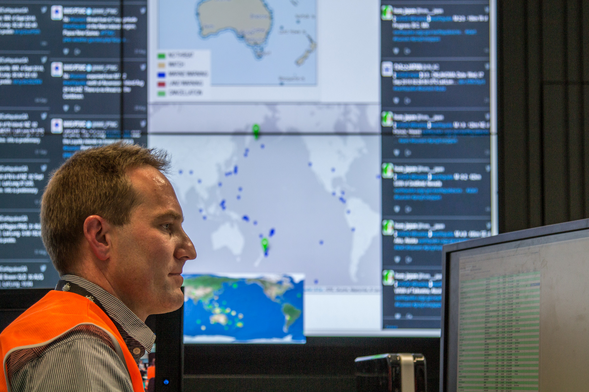
Image: The Joint Australian Tsunami Warning Centre (JATWC), based in Melbourne and Canberra, is operated by the Bureau and Geoscience Australia.
Tsunami detection buoys
A network of six deep-ocean tsunami detection buoys provides the backbone of Australia’s ocean monitoring and forms a critical part of global monitoring in the Indian and Pacific oceans. The buoys are located in pairs (to provide immediate backup) in three sites that are particularly prone to earthquakes: two in the Indian Ocean, close to the Sunda Trench; two in the Coral Sea, on the edge of the Pacific Plate; and two in the south Tasman Sea, close to the Puysegur Trench.
The buoys are extremely accurate—providing instant alerts and verification of sea-level changes caused by tsunamis—measuring changes in deep-ocean sea levels as small as 1 mm (it is only in shallow water that tsunamis grow to threatening heights). Each buoy costs more than $1 million to build and deploy, and their exposure to heavy weather incurs significant maintenance costs.

Image: Deep-ocean tsunami detection buoys form part of the Bureau's enhanced sea-level monitoring network.
Tide gauges
The Bureau also maintains a network of 43 tide gauges attached to coastal piers and jetties around Australia, our offshore islands, and in our 14 partner countries in the Pacific. Data from the gauges and buoys are updated every minute through JATWC’s phone and satellite network, added to real-time data servers linking hundreds of other gauges and buoys across the world’s oceans, and exchanged freely in real time between countries.
Computer modelling
The Bureau’s sophisticated computer modelling software holds the key to predicting tsunami threats and determining the need for any warnings. Modelling is performed on a powerful supercomputer that uses data on the location, depth and magnitude of earthquakes to simulate how much water could be displaced by the seafloor movement—and in which direction it is likely to travel. The speed and precision of the Bureau’s supercomputer enables us to create a vast database of tsunami scenarios from all possible major undersea earthquake sources around the globe.
Animation showing monitoring, detection, analysis and warning of the Australian Tsunami Warning System. Credit: Geoscience Australia.
How does the system work?
When Geoscience Australia (GA) registers an undersea earthquake of magnitude 6.5 or above through its monitoring of global seismic data, it lets the Bureau know the location, depth and magnitude within 10 minutes of the earthquake occurring. The Bureau then combs through its database of pre-computed tsunami simulations to find the best match to GA’s seismic and locational data, from which it assesses the potential of a tsunami threat to Australia and countries across the Indian Ocean.
JATWC’s goal is to provide tsunami warnings within 30 minutes of any magnitude 6.5+ undersea earthquake occurring anywhere in the world, providing Australians with at least 90 minutes’ warning of any threat—as well as critical information for Indian Ocean countries, and valuable data for the Pacific Ocean system.
Most earthquakes pose no tsunami threat to Australia, and JATWC will issue a National No Threat Bulletin when it assesses the threat to be either non-existent or negligible. On average, JATWC issues No Threat Bulletins about once a week, reassuring Australians that we are fully aware of large earthquakes happening around the world—but they pose no tsunami threat to us.
If modelling indicates a potential threat, JATWC will immediately issue a Tsunami Watch for relevant areas of the Australian coastlines. It will then monitor its ocean and coastal networks to see if a tsunami has developed, how dangerous it is, and where it is heading. If a tsunami is confirmed or the threat is within 90 minutes of Australia, the Watch will be upgraded to a Tsunami Warning—repeatedly reissued on an hourly basis or updated when new information is available—detailing which coastal zones are under what specific level of risk.
There are two categories of tsunami threat:
- a Marine Threat for dangerous coastal conditions such as strong currents and surges, when people should get out of the water and move away from the water’s edge, but do not need to evacuate; and
- a Land Threat, when low-lying coastal areas may be inundated, and people should move at least 1 km inland or to a location at least 10 m above sea level.
As soon as JATWC confirms the existence of a tsunami threat, the Bureau will give the relevant emergency authorities a ‘heads-up’ call before specific warnings are issued. We also liaise closely with national and regional media to ensure that the public receives timely warnings on radio and TV, as well as via the Bureau’s website and a dedicated tsunami hotline (1300 TSUNAMI). The warnings are also delivered to a number of other relevant authorities and organisations, such as port and maritime authorities, the Department of Defence, Surf Life Saving Australia, and the Australian Maritime Safety Authority. JATWC also provides tsunami threat advices for all Indian Ocean coastlines to national tsunami warning centres around the Indian Ocean rim.
More information
More information on JATWC and the Australian Tsunami Warning System can be found at:

Subscribe to this blog to receive an email alert when new articles are published.
Comment. Tell us what you think of this article.
Share. Tell others.