
Understanding fire weather
05 September 2017
Updated 9 October 2023
Weather conditions influence the size, intensity, speed and predictability of bushfires – and how dangerous they can be. Large fires can even create their own weather. Understanding fire weather is important to help you prepare for bushfires, at any time of year.
When is fire season?
Dangerous bushfire activity can happen at any time.
Generally, peak bushfire activity varies with seasonal weather patterns across Australia. The peak fire danger seasons are:
- June to November in northern Australia
- mid-October to mid-January in central latitudes
- December to February in Southern Australia.
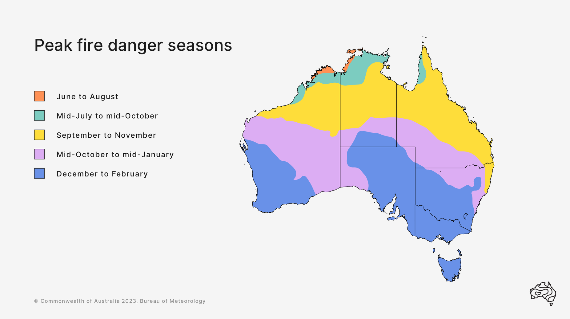
Image: fire seasons in different parts of Australia
What influences fire behaviour?
Weather-related factors that contribute to an increased risk of bushfire danger include:
- high temperatures
- low humidity
- little recent rain
- dry vegetation
- strong winds
- thunderstorms.
Vegetation that can fuel bushfires dries out and becomes more flammable when:
- the weather is hot
- humidity is low
- there's little recent rain.
Periods of wet weather can also contribute to increased bushfire risk. Wet weather encourages vegetation growth. This increases the amount of fuel available for bushfires if dry weather follows.
Strong winds also contribute to fire behaviour. Gusty winds can fan flames causing a fire to spread faster, reducing the time you have to prepare.
Above the fire, strong winds can carry hot embers long distances. These can start ‘spot’ fires many kilometres ahead of the main fire front.
A change in wind direction can bring a dangerous period of bushfire activity. This is often seen as a trough or cold front, also known as a cool change. It can shift the direction of the wind, altering the course of the fire and broadening the fire front.
Large fires can create their own thunderstorms, known as pyrocumulonimbus. These storms can cause erratic, more intense and dangerous bushfire behaviour. This includes strong winds and lightning strikes causing new fires.
The intense heat from a bushfire causes air to rise rapidly in the smoke plume. When the plume raises high enough, low atmospheric pressure causes the air to cool and a cloud to form. In an unstable atmosphere a thunderstorm can develop. This is a pyrocumulonimbus cloud.
How do I know if my area is at risk of fire?
Our fire weather services work to keep Australians safe. These include:
- fire weather warnings, when forecast conditions are likely to be dangerous
- fire danger ratings, in consultation with fire agencies
- fire danger products, such as detailed forecasts for fire agencies and other organisations.
We work with emergency services across Australia to keep the community informed about fire danger.
Fire danger ratings
One way we do this is with fire danger ratings. This rating shows how difficult it will be to control or suppress a fire. They help the community know when to put their bushfire survival plan into action. Fire danger ratings are set by state and territory fire agencies. They are based on weather and other conditions, including:
- temperature
- humidity
- wind
- fuel conditions.
Four levels of fire danger ratings communicate the level of bushfire risk – from moderate to catastrophic. 'No rating' may be shown when there is low risk during the fire season.
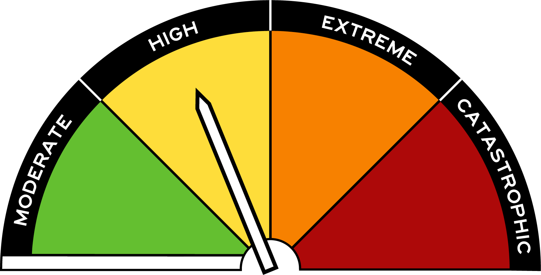
Image: This dial shows how fire danger ratings appear on road signs around the country. This one shows fire danger as high.
What to do when there’s a risk of fire
No matter the fire danger rating, it's important to have a bushfire plan in place. Proper planning ensures you know what to do if a bushfire starts. Regardless of whether you live in, or travel to, an area threatened by fire.
On days of dangerous bushfire activity:
- stay in touch with emergency services and local fire agencies
- tune into your local emergency broadcaster.
More information
View current warnings on our website. You can also get warnings for your location using the BOM Weather app.


Comment. Tell us what you think of this article.
Share. Tell others.