
Explainer: what is fog?
29 August 2018
Thick fog can make a stroll in the backyard feel like you're in a spooky film and throw a spanner in the works for your travel plans by disrupting flights. So what causes fog, are there different types of fog and how will you know if one is coming to blanket your world?
The World Meteorological Organization defines fog as a suspension of very small water droplets in the air, that reduce visibility at ground level to less than one kilometre.
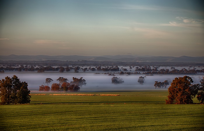
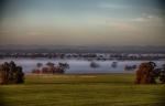
Image: Fog on the outskirts of Dookie, Victoria, 2 August, 2018. Credit: RenSmart Photography
How does fog form?
Fog forms in the same way as cloud, except the process takes place at the surface rather than higher in the atmosphere. For both fog and clouds to form, the air temperature needs to cool to the dew-point temperature—the temperature at which condensation occurs. Once this happens, the invisible water vapour that surrounds us condenses into tiny water droplets and it is these that form fog.
The most common way the air cools is overnight as the ground radiates (loses) the heat it absorbed during the day. The greatest rate of radiation occurs when skies are clear and winds are very light, which happens when a high pressure system is controlling the weather.
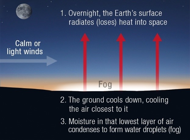
Not all high-pressure systems produce fog though. It only forms when conditions are 'just right'. If there is too much wind, low clouds form rather than fog. If there is too little or no wind, dew forms on the grass instead.
The other critical factor in fog formation is the amount of moisture in the atmosphere. This is measured by the dew-point temperature, which represents how much moisture is in the air—the higher the dew-point temperature, the greater the atmospheric moisture content. The key requirement for fog formation is for the air temperature and dew-point temperature to be very close together. If this occurs—and the winds are 'just right'—then the chance of a fog forming are very high.
This means the difference between the daytime temperature and dew-point temperature also plays a part in how likely fog is to form. If the difference is too great, night-time temperatures won't cool down enough for condensation to occur.
Since fog formation depends on these precise wind and temperature combinations, forecasting it can be challenging.
A classic pattern for fog formation is to have rain falling late in the day, followed by the arrival of a high-pressure system that brings clear skies and light winds overnight. The rain increases the dew-point temperature, while the light winds and clear skies overnight maximise the cooling of the air. This type of set-up often leads to some of the thickest fogs.
What types of fog are there?
A fog that forms by the process above is known as a radiation fog and they are the most common type we see, but there are other types of fog.
Advection fogs form by warm moist air moving over a cool surface. A type of advection fog that can be a spectacular sight is sea fog. These fogs are seen around the world and can form wherever warm moist air flows onto cooler land surfaces.
Upslope fog forms when moist air is forced up a terrain slope and cools to saturation. This can happen over abrupt terrain such as hills or mountain, but a gentle slope can work just as well.
Fogbows
Fogs can also produce a type of rainbow known as a fogbow. They form in the same way as rainbows, with the sun's rays being refracted and reflected by the water droplets in the fog. However, fog droplets are typically much smaller than the rain drops that form rainbows. This leads to smaller amounts of refraction and reflection so the colours in a fogbow are less distinct and often appear to be white.
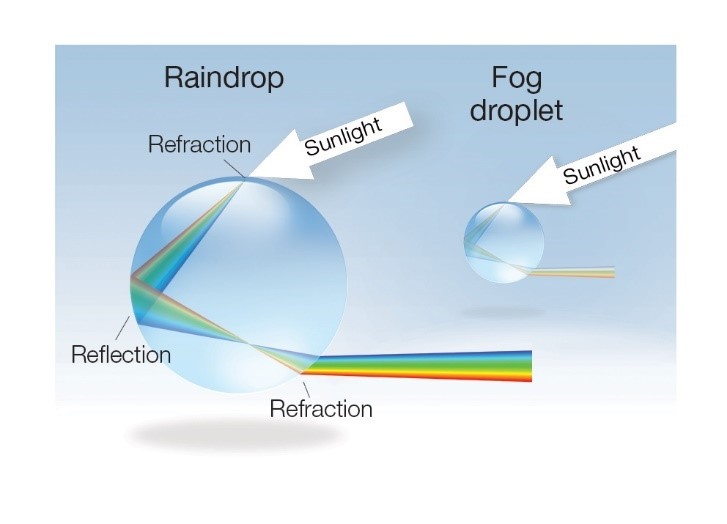
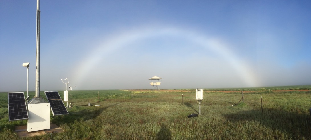
Image: Fogbow at Cunderdin airstrip, Western Australia, 24 August 2018
What's the difference between fog and mist?
Fog reduces horizontal ground-level visibility to less than 1km. If you can see for further than 1 km it's not fog, it's mist.
Fog extremes
Fogs can occur at any time of the year, but in Australia they are most common during the winter months. The foggiest city in Australia is Canberra with an average of 47 fog days.
Canberra can't hold a candle to the foggiest place on Earth though, which is an area of the Atlantic Ocean lying off the coast of Newfoundland called the Grand Banks. This is where the warm Gulf Stream from the south meets the cold Labrador Current from north and leads to an average of over 200 fog days per year.
Fogs in Australia tend to last only a few hours after sunrise, as the warming from the sun causes temperatures to rise and the water droplets in the fog slowly evaporate. In other parts of the world though fogs can hang around for a number of days, causing huge disruption to air travel.
Probably the most infamous fog in recorded history occurred in London in December 1952, when a combination of air pollution and perfect conditions for fog formation led to a 4-day fog. This event claimed the lives of at least 8000 people, who died due to complications caused by inhaling coal smoke trapped by the weather conditions.
How will I know if fog is on the way?
Check our daily forecasts—if fog is expected you’ll see it mentioned there and shown in our online forecast tool MetEye (select 'fog' from the left-side menu under 'storms, snow, fog, frost'). Fog can also be a factor in our road weather alerts, issued in some areas when the weather is expected to make driving conditions dangerous. The aviation industry keeps a close eye on our fog information too. While fog is something most people and businesses can work around, for airlines it can mean grounded flights and changing schedules ahead of time so passengers can prepare for a delay.

Comment. Tell us what you think of this article.
Share. Tell others.