
What's that cloud?
15 February 2016
Of all weather phenomena, clouds are among the most fascinating. From the silky, high-altitude cirrus to the towering, threatening mass of storm-bearing cumulonimbus, clouds are as varied as the weather itself.
Apart from their beauty and interest, clouds can provide a useful indication of what weather conditions may be on the way. By knowing the ten main cloud classifications, you can get a real sense of what’s happening in the atmosphere.
AskBOM video: What's that cloud?
Cloud formation
Clouds have their origins in the water that covers 70 per cent of the Earth's surface. Millions of tons of water evaporates into the air daily from oceans, lakes and rivers, and by transpiration from trees, crops and other plant life.
As this moist air rises, it encounters lower pressures, causing it to expand and cool. As air cools it can hold less water vapour and eventually will become saturated. At that point, some of the water vapour condenses into tiny water droplets (a million times smaller than raindrops), forming clouds. Thus, whenever clouds appear, they provide visual evidence of the presence of water in the atmosphere.
Cloud classification
There are ten main cloud types, which are further divided into 27 sub-types according to their height shape, colour and associated weather. Clouds are generally categorised by where they sit in the atmosphere: low—from the earth’s surface to 2.5km; middle—2.5 to 6km; or high—above 6km.
Clouds are given Latin names which describe their characteristics—such as cirrus (a hair), cumulus (a heap), stratus (a layer) and nimbus (rain-bearing). All clouds are actually white in colour, but when viewed from the ground some appear grey or dark grey according to their depth and shading from higher cloud.
You’ll generally notice two different appearances of clouds—layers of cloud that look like sheets, and clumpy clouds that look like smoke plumes.
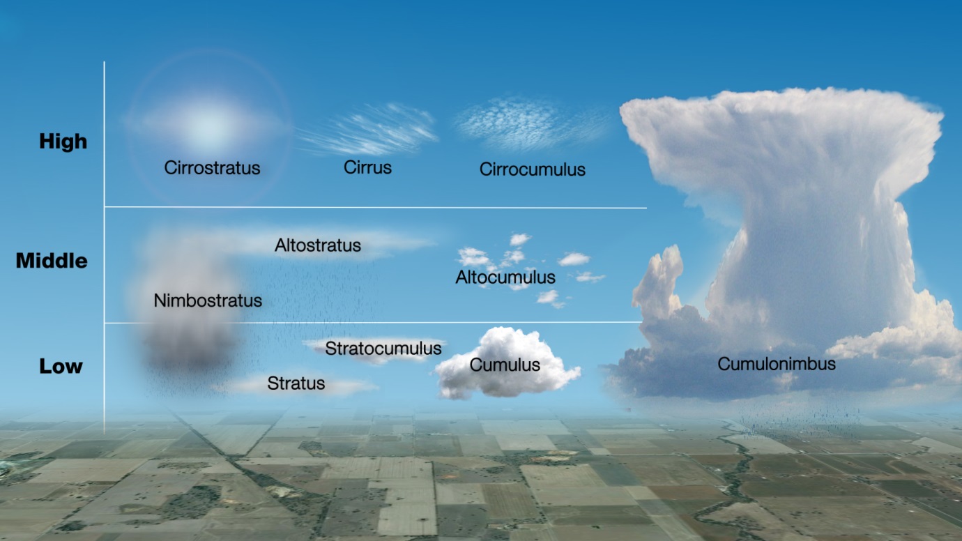
The ten main types of cloud
The layer cloud types are known as stratiform and are classified as:
- stratus—found in the low levels of the atmosphere, tend to produce a light drizzle;
- altostratus—('alto' meaning high), found in the middle level, tend to be very good rain producing system for large areas across Australia, particularly inland;
- nimbostratus—formed when altostratus undergoes further vertical development, allowing the cloud to hold more moisture, and causing the cloud base to lower and produce heavier rainfall; also appears darker in colour; and
- cirrostratus—found in the higher levels of the atmosphere, white and wispy, and made of ice crystals. We often get a lot of halo activity with cirrostratus cloud, with the ice crystals refracting light around the moon and the sun.
The clumpy cloud, when in the lower part of the atmosphere, is classified as cumulus cloud:
- cumulus—low level cloud which tends to produce short duration, fairly intense rainfall that is often very localised, meaning that rain falling at your house might not be falling at your neighbour’s a kilometre up the road;
- stratocumulus—found in the lower levels, a blend between stratiform and cumuliform cloud and taking on appearances from both these cloud types, may produce drizzle;
- altocumulus—found in the middle levels, looks like sheep in the sky, may produce light showers;
- cirrocumulus—small, rippled, higher level cloud, does not produce precipitation; and
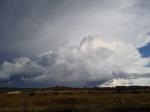
- cumulonimbus—the largest cloud of all, forms in the lower layer of the atmosphere but extends through all three layers right to the top of the atmosphere. Also known as thunderstorm cloud, producing thunder and lightning.
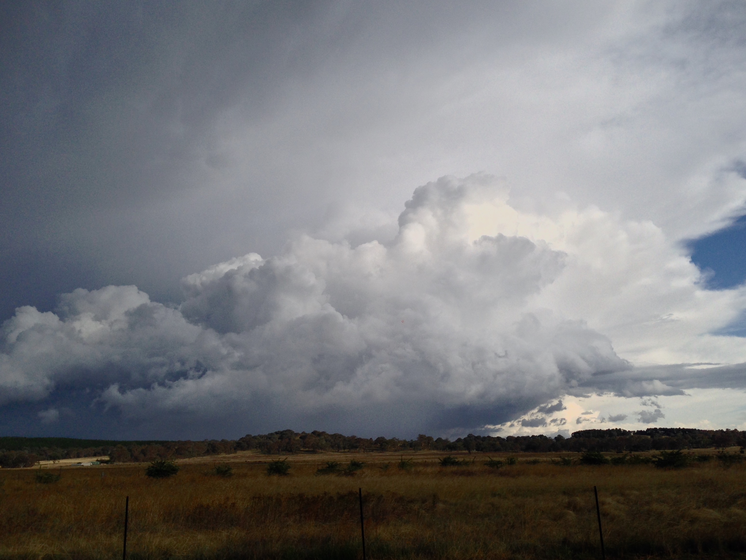
Cumulonimbus cloud, Canberra (Credit: Karna Nair)
Some of the more visually spectacular cloud happens very high up in the atmosphere, and is classified as cirrus cloud:
- cirrus—formed of ice crystals moving very quickly through the atmosphere, occurring at temperatures around –40°C to –60°C, does not produce precipitation.

Comment. Tell us what you think of this article.
Share. Tell others.