
Sydney storms could be making the Queensland fires worse
29 November 2018
A strong low pressure system saw severe thunderstorm and hail warnings in effect for much of the New South Wales South Coast on Wednesday. At the same time, very dry conditions, strong winds and high temperatures fuelled dozens of bushfires across Queensland. The two events actually influenced each other. As the low pressure system moved over the Greater Sydney area, a connected wind change pushed warm air (and stronger winds) to Queensland, worsening the fire conditions.
These lows over NSW are the kind we might see a couple of times a year – they’re not just regular weather systems, but neither are they massively out of the ordinary.
However, when combined with the current record-breaking heat in Queensland, the extra wind created exceptionally dangerous fire conditions. Queensland’s emergency services minister, Craig Crawford, warned Queenslanders:
We are expecting a firestorm. We are expecting it to be so severe that it won’t even be safe on the beach […] The only thing to do is to go now.
Video: satellite vision of the smoke plumes from bushfires burning in Queensland,
29 November 2018.
Conditions in Queensland
At least 80 bushfires were burning in Queensland on Wednesday, with more than a dozen fire warnings issued to communities near the Deepwater blaze. Queensland Police Deputy Commissioner Bob Gee said that 'people will burn to death' unless they evacuate the area.
These fires have come during a record-breaking heatwave. On Tuesday Cooktown recorded 43.9 °C, beating the previous November high set 70 years ago by more than 2 °C. Cairns has broken its November heatwave record by five whole degrees.
Grasslands and forests are very dry after very little rain over the past two years. Adding to these conditions are strong winds, which make the fires hotter, faster and harder to predict. This is where the storm conditions in NSW came in: they affected air movements across both states.
NSW low driving winds over Queensland
A large low pressure system caused the NSW storms. As the low moved, it pushed a mass of warm air ahead of it, bringing both higher temperatures and stronger winds across the Queensland border.
Once the low-pressure system moved across the Hunter area to the Tasman Sea east of Sydney, it dragged what we call a 'wind change' across Queensland. This increased wind speeds through Queensland and temperatures, making the fire situation even worse.
This is why emergency services are keeping watch for 'fire tornado' conditions. When very hot air from large fires rises rapidly into a turbulent atmosphere, it can create fire storms—thunderstorms containing lightning or burning embers. Strong wind changes can also mean fire tornadoes form, sucking up burning material. Both of these events spread fires quickly and unpredictably.
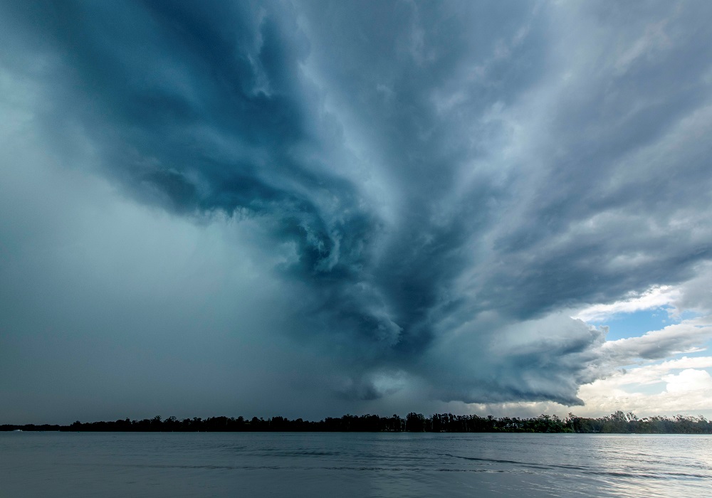
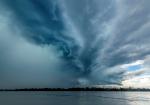
Image: Storm front at Port Macquarie, NSW, 28 November 2018. Credit: Will Eades
What does this mean for the drought?
Unfortunately, it’s not likely the heavy rains over NSW will have a long-term effect on the drought gripping much of the state. While very heavy rains have fallen over 24 hours, the drought conditions have persisted for years.
The wet weather may bring some temporary relief, but NSW will need much more rain over a longer period to truly alleviate the drought.
In the meantime, we're monitoring the Queensland situation closely. You can check weather warnings for your area on our website.
More information
Turn and burn: the strange world of fire tornadoes
Trust Me, I'm An Expert: Australia's extreme weather
Drought, wind and heat: when fire seasons start earlier and last longer
![]()
This article is republished from The Conversation under a Creative Commons license. Read the original article.

Subscribe to this blog to receive an email alert when new articles are published.
Comment. Tell us what you think of this article.
Share. Tell others.