


El Nino drawing closer to an end
10/05/2016
The tropical Pacific Ocean has weakened to borderline El Niño-neutral levels.
Sea surface temperatures across the tropical Pacific Ocean cooled further in the past fortnight, driven by cooler than average waters below the surface.
Atmospheric indicators are also trending towards normal. Trade winds have been consistently near normal for some weeks. Typical El Niño cloud patterns are dissipating and the Southern Oscillation Index (SOI), while still negative, is steadily rising.
All international models suggest the tropical Pacific Ocean will continue to cool, with seven of eight models exceeding La Niña thresholds by September 2016. However, individual model outlooks show a large spread between neutral and La Niña scenarios.
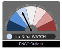
Based on recent changes in the tropical Pacific Ocean and atmosphere, combined with current climate model outlooks, the Bureau's ENSO Outlook remains at La Niña WATCH. This means the likelihood of La Niña forming later in 2016 is around 50%.
Typically during La Niña, winter-spring rainfall is above average over northern, central and eastern Australia.
Very warm sea surface temperatures continue across large parts of the Indian Ocean. Likewise, ocean temperatures around Australia remain well above average.
Warmth in these two regions may provide extra moisture for rain systems as they cross Australia during the coming months.
The latest ENSO Wrap-Up, ENSO Outlook and Climate Model Summary are now available on the Bureau's website.
