


La Nina on the way out as Australia heads into autumn
28/02/2018
The Bureau of Meteorology has issued its autumn Climate Outlook, noting a weak La Niña pattern will continue to decline with a likely end in autumn.
Following a summer that brought above average rainfall to Western Australia and the Top End of the Northern Territory, but below average precipitation for much of eastern Australia, Tasmania is the only state that appears likely to have above average autumn rain.
March is likely to be drier than average for much of the interior extending into northern Queensland. There is an increased chance for a wetter than average March in parts of eastern Australia and Tasmania.
Daytime and overnight temperatures for autumn are likely to be warmer than average over much of the country, with strongest chances in northern Queensland and Tasmania. Cooler nights are favoured in northern WA.
Looking at the start of autumn, March daytime and overnight temperatures are likely to be cooler in the west and the southern mainland, but warmer in Queensland, the NT and Tasmania.
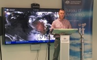
The Bureau of Meteorology's Manager, long-range forecasting, Dr Andrew Watkins, said a weak La Niña pattern remains in the tropical Pacific, but continues to decline with a likely end in autumn.
"This La Niña has only had a weak influence on Australian climate, particularly when compared to the last La Niña (2010-12) when Australia experienced its wettest two years on record," Dr Watkins said.
"Historically, autumns following the end of weak La Niña events have been drier than average, however record-high water temperatures in the Tasman Sea may increase rainfall from any east coast lows that form later in the autumn and winter," he said.
A range of climate products and services are available on the Bureau’s website to help inform decision-makers and the general public.
The rainfall and temperature climate outlook maps show the likelihood, as a percentage, of experiencing wetter/drier and warmer/cooler than average weather for the upcoming three months.
Climate Outlooks are released fortnightly from August 2017, with new mid-month Outlooks complementing our regular end-of month look at likely rainfall and temperatures for the season ahead.
View the latest outlook: http://www.bom.gov.au/climate/outlooks/#/overview/summary
Videos and maps are also available: http://www.bom.gov.au/climate/ahead/
A copy of the video from today's media conference is available for download.
And state-based audio news releases are available by request from media@bom.gov.au
