

Monsoon arrives late in Darwin
12 February 2025
The monsoon has finally arrived in Darwin. Why was it so late, and what does this mean for the rest of the northern Australian wet season?
The monsoon arrived in Darwin on 7 February 2025. It's the latest known arrival since records began. The previous record was 25 January 1973.
Hot, sticky and uncomfortable
Before the onset of the much-anticipated monsoon, northern Australia endures the build-up – a time of extreme heat and humidity.
The monsoon is associated with increased rainfall and some relief to the oppressive heat.
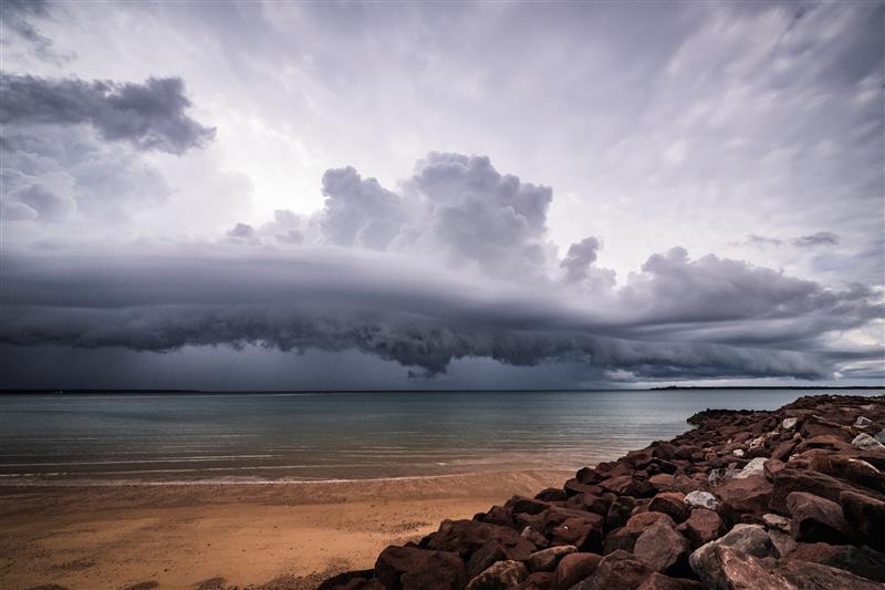
Image: Each year the monsoon brings clouds, rain and some relief from humidity in northern Australia. Credit: Patch Clapp
What is the monsoon?
The monsoon is a seasonal shift in the winds that brings widespread, persistent rainfall. It forms when a giant sea breeze circulation draws in moisture from our surrounding oceans over areas of lower pressure on land. The winds reverse and humidity builds, before bursting as broad areas of heavy rain that cool the Top End.
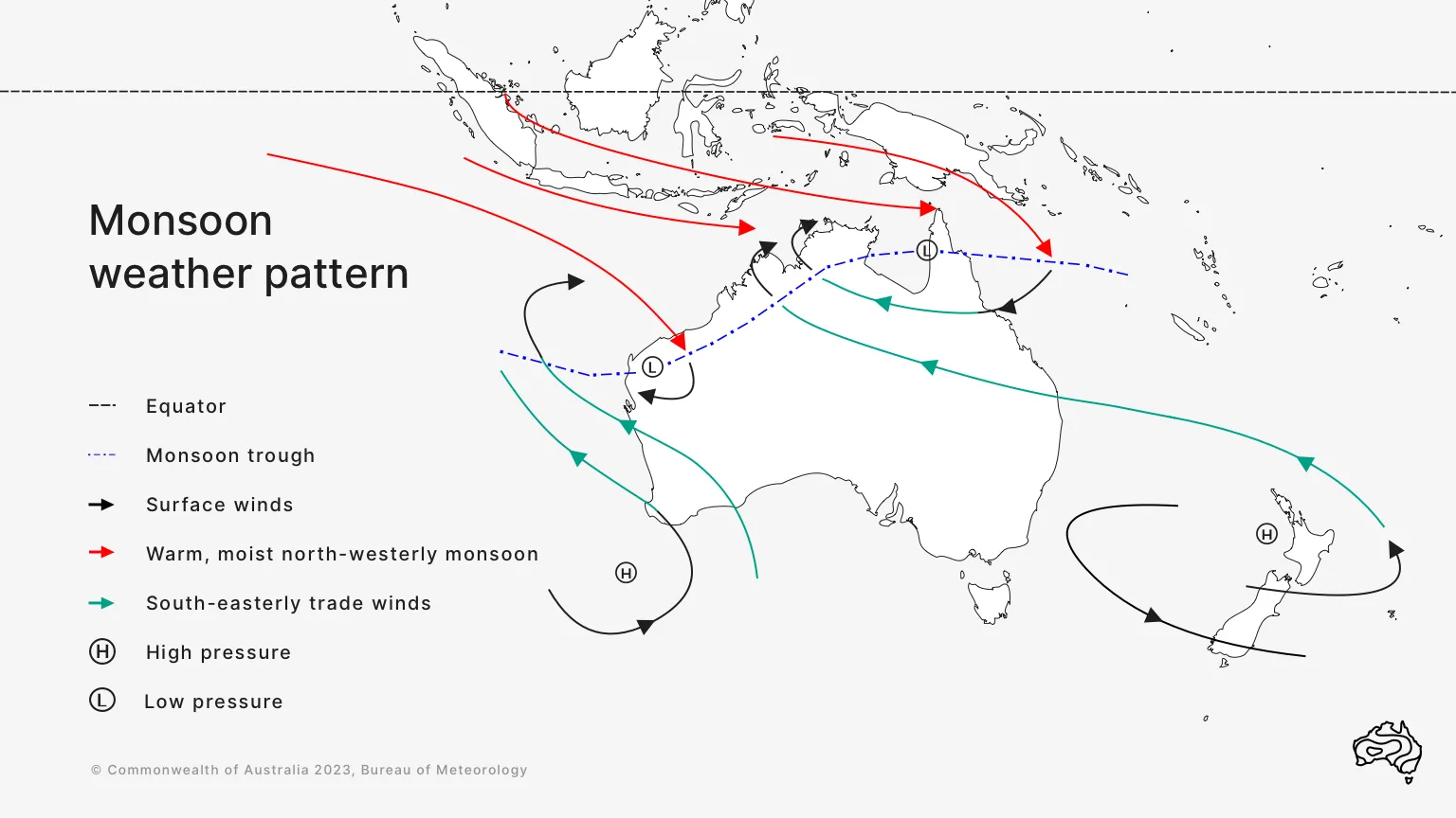
Diagram: Synoptic patterns typically associated with the active phase of the northern Australian monsoon. The monsoon trough is an area of low pressure.
Australia's official northern wet season is from 1 October to 30 April. Active monsoon periods may occur at any time during this period. However, the monsoon onset, as defined by the reversal of the winds, normally occurs in late December around Darwin.
The onset of the monsoon at Darwin is determined by specific wind criteria. We use these criteria as it allows the longest comparison with historical monsoons. Reliable wind data at Darwin Airport started in the 1957–58 wet season. However, monsoon-like conditions can occur in other parts of northern Australia without affecting Darwin at the same time.
While the monsoon was late to arrive in Darwin, the monsoon trough was established over Queensland from the end of January and also briefly in northern Western Australia. This brought heavy rainfall and has led to major flooding.
Why was the monsoon so late?
The broadscale weather patterns associated with the monsoon didn't develop over northern Australia until much later than usual this wet season.
The Madden–Julian Oscillation is a slow-moving pulse of cloud and rainfall in the tropics that circles the globe and can lead to bursts and breaks in monsoon rain. It appeared in the Australian region in early December 2024 and returned in late January 2025. It enhanced the cloudiness and the wind patterns needed for monsoon onset.
What does this mean for the rest of the wet season?
A later monsoon onset typically doesn't lead to an extended wet season.
But there may be fewer monsoon bursts than usual this wet season, due to the delayed start. A burst is an active phase of the monsoon, characterised by broad areas of cloud and rain.
On average, more than half of northern Australia's annual rainfall is associated with active bursts of the monsoon during the wet season.
Is the monsoon changing?
There is no clear trend in monsoon onset dates. There has been a monsoon in Darwin every year since reliable records began in 1957–58.
The best way to know what’s expected in the months and seasons ahead is through our long-range forecasts.
More information
Long-range forecasts for rainfall over the coming weeks and months
The wet and the dry: seasons in the tropics
Subscribe to receive climate information by email.

Comment. Tell us what you think of this article.
Share. Tell others.