
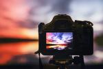
How to take great weather photos
16 January 2019
Have you ever dreamed of having a photo of yours in the Australian Weather Calendar? We've picked the brains of past winners and weather experts, to bring you these top tips for taking phenomenal photos of weather.
The Australian Weather Calendar photo competition
Every year people send us hundreds of photos of weather from around Australia and its territories, hoping theirs could feature in Australia’s bestselling weather calendar. The winning images will spend the next year hanging in nearly 70 000 homes and offices across Australia and the world.
Our judges are looking for high-quality shots (they need to be sharp when enlarged and reproduced) that capture weather in a unique, spectacular or visually appealing manner. The judges choose photos for their creativity and aesthetics, the weather phenomena shown and some other factors—for example, we try to feature photos from as many parts of Australia and its territories as we can.
We're looking for real images of weather, with as little editing or enhancement as possible. We ask finalists for the 'raw' (unedited, unprocessed) files from their cameras, which shouldn't look wildly different from what they entered into the competition. Technical experts scrutinise images to ensure only the most authentic photos make it into the calendar.
Entries for each year's photo competition open on 1 July and close on 31 March. Read the full conditions of entry at www.bom.gov.au/calendar/contest.
Equipment and preparation
It sounds obvious, but to be ready for that special shot, you need to carry the right camera and be weather aware.
Our winning photographers all have their preferred gear and gadgets, with many using good DSLR cameras to capture shots that will be clear and sharp when enlarged in the calendar. But capturing a great image can also mean rolling down the car window and using your iPhone, as Lucy Stevenson did with the funnel cloud below.

Funnel cloud off the Monaro Highway, New South Wales, taken by Lucy Stevenson (April, 2015 calendar).
Some of the most visually impressive weather moments occur when there's not much light around – such as sunrise, sunset, lightning in the night sky and the aurora australis. Low light conditions drastically affect the quality of the image – consider using a tripod.
To take great weather photos, it really helps to stay on top of…the weather! Kylie Gee (September, 2017 calendar) recommends, 'Keep an eye on current and advance forecasts. Being aware of potential weather events is crucial to "being in the right place at the right time" which is key to capturing unique weather phenomena.
You also need to think about where you'll get the best view of the weather. Pamela Pauline (April, 2017 calendar) says, 'The best weather photographs are when there aren’t a lot of distracting features in the foreground, like buildings, unless there is something interesting about how the weather affects the buildings, such as lightning strikes. Find a vantage point that allows a great view of the sky'.
Composition
So how do you frame your photo? The main focus should be on the sky/weather. Consider things that might obstruct this focus, so move away from power poles or anything that obstruct your view. That said, for such a grand-scale image as a sky full of weather, using a 'foreground anchor' (something small-scale in the foreground to lead you into the image) works well.
Mieke Boynton (Cover, 2017 calendar) suggests, 'Have a personal checklist of places to go where you're likely to get a good shot if there's some good sky activity … A nice single tree standing by itself in a clear field so that you walk around and photograph it from any angle, depending on where the storm is, or an old building, or a rocky outcrop in the middle of a field. Basically any object of interest that doesn't have lots of trees around it, obstructing the sky'.
Lightning
Lightning is one of nature's most spectacular displays – and the right image of it really packs a punch in the calendar as well! For the calendar we look to reproduce striking weather as it appeared to the naked eye – and lightning presents plenty of challenges. We receive many photos that capture it with time-lapse, where you can see motion blur, but that's not a realistic view of what happened in the moment.
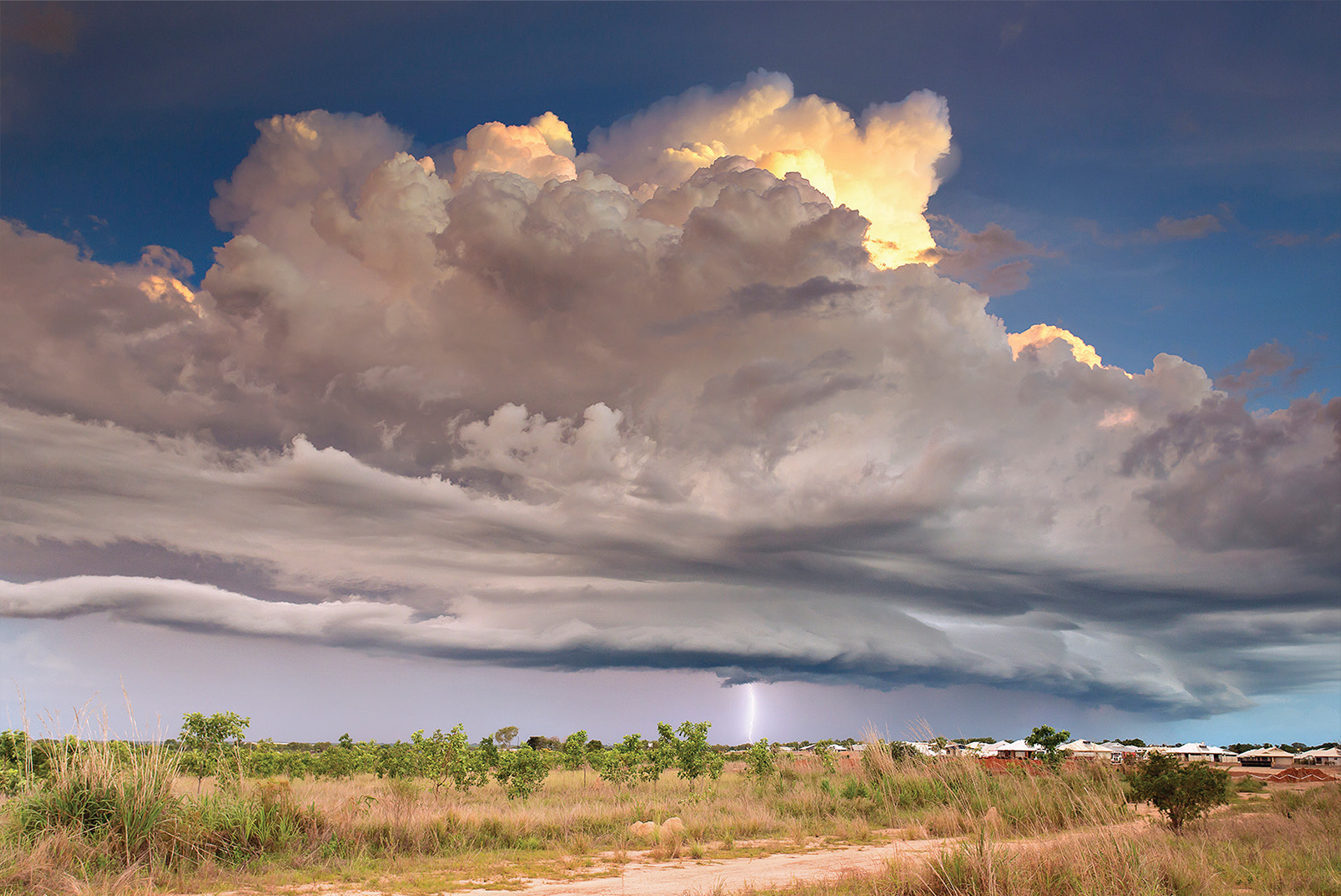
Lightning over the Darwin suburb of Muirhead in the Northern Territory by Louise Denton (May, 2015 calendar)
Louise Denton uses a lightning trigger for daytime storm photography. This requires setting up your camera manually, including manual exposure and manual focus. 'The ideal shutter speed is typically less than 1/50 s,' says Louise, 'and a wider aperture will help capture more of the lightning, but the exact settings will depend on your unique lighting conditions, subject, camera/lens and storm distance.'
To see if lightning is occurring near you, or if a storm that's producing lightning is approaching, use the Lightning layer on our satellite viewer. The 'IR + Zehr' layer is also useful for spotting deep convection in clouds that could produce thunderstorms.
Lightning strike at the Australian Stockman Hall of Fame in Longreach, Queensland, by Helen Day (November, 2017 calendar)
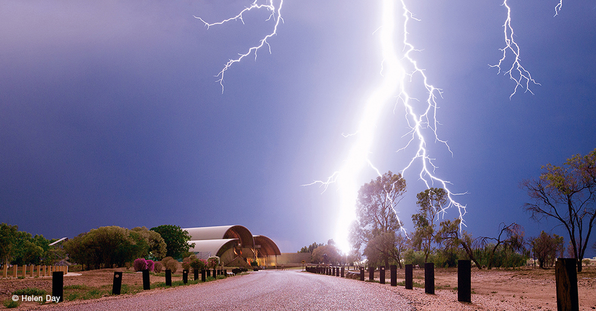
Helen Day uses our rain radar to see where the storm is likely to be and to get herself there in good time to set up. She finds 'If the radar is showing predominantly brown and orange, that means there is going to be more lightning than rain. If the radar is showing a lot of blue, I don't bother to go out as there will be more rain than lightning.'
Always remember that lightning is dangerous – and the storms that produce it can also bring dangerous winds, flooding, large hail and even tornadoes. Helen tries to keep down and as close to her car as possible, so she can take shelter if the lightning gets too close.
Kylie Gee (September, 2017 calendar) says her motto is: 'A good [storm] chase is a safe chase'. She encourages anyone new to weather photography to go out with a seasoned storm-chaser until they can learn the do's and don'ts of a safe chase. Use the BOM Weather app to keep an eye on the rain radar and any weather warnings while you're out and about. If you're near a capital city, our Severe Thunderstorm Warnings include the locations of storm cells, which way they're heading and how soon they're expected to reach each point in their path.
Kylie suggests identifying, ahead of time, locations in your area that would make a suitable foreground for your images and/or afford you a good view of storms: 'It's important not to waste valuable time hunting around for a suitable location… Most people will not be interested in purchasing a print of lightning if it's captured from your front door and shows the neighbour's houses, rooftops and powerlines. A photo is more likely to sell if it's captured at a location they identify with, e.g. beaches, lighthouses, prominent city buildings, popular landmarks, jetties or piers.'
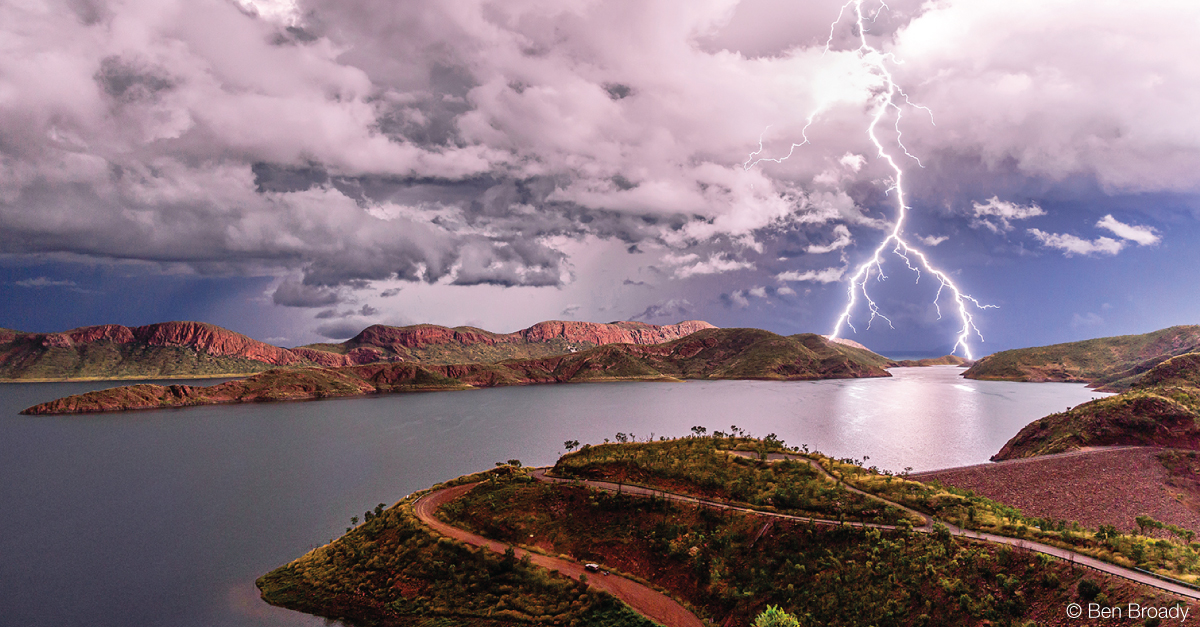
Forked lightning over Lake Argyle in the Kimberley, Western Australia, by Ben Broady Fine Art Photography (July, 2018 calendar)
Ben Broady recommends setting your focus manually to infinity for lightning photography. He also uses the BOM Weather app radar to keep track of each storm: ' Where's it going? What's it doing?'
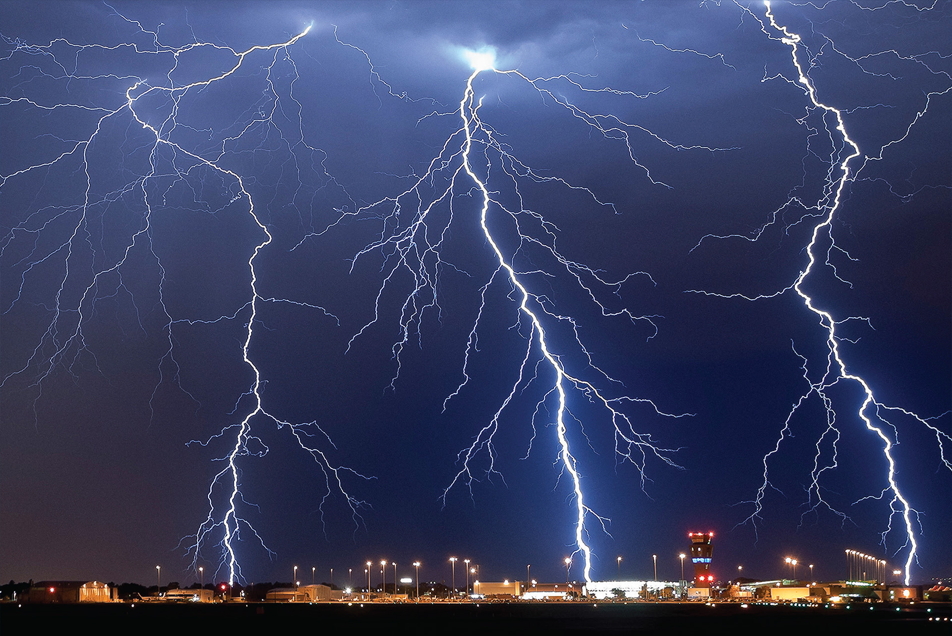
Three simultaneous lightning strikes over Adelaide Airport in South Australia by Rowland Beardsell (December, 2015 calendar)
Bureau weather observer (and experienced weather photographer) Rowland Beardsell says, 'The sudden, unpredictable nature of lightning bolts makes framing your photo tricky … or an exercise in luck!' He set up his camera on a tripod, with a remote control taking exposures every 20 seconds, and was lucky enough to capture three lightning strikes in one shot for the 2015 calendar. (And don't let anyone tell you lightning never strikes twice in the same place – Rowland had another lightning photo on the cover of the 2019 calendar!)
Rainbows
Bright sunlight, suspended droplets of water (rain, spray or fog) and the correct angle of the sun are essential conditions to see a rainbow. For rainbows to be visible in the sky, the sun must be behind the observer at 42° elevation or lower. As such, rainbows are more likely to be seen towards the end of the day when the sun is lower in the sky.
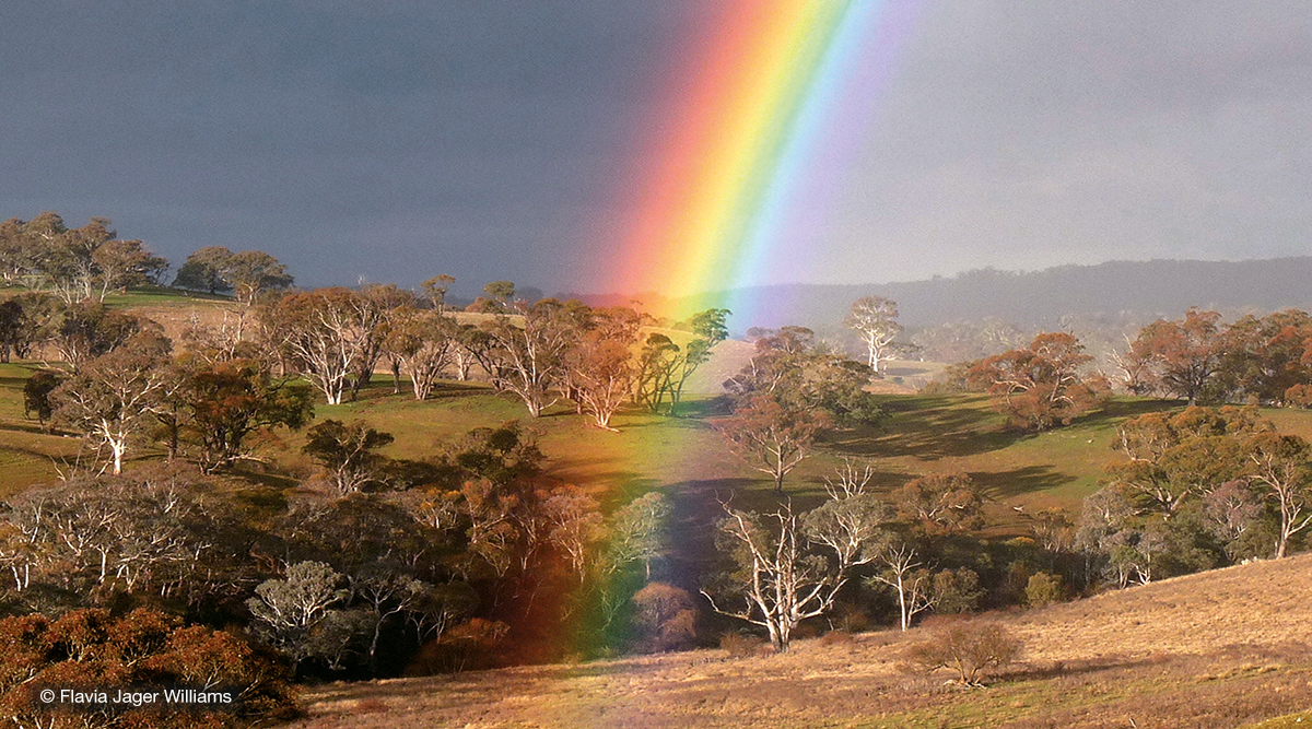
Rainbow in the Southern Tablelands of New South Wales by Flavia Jager Williams (August, 2017 calendar)
Flavia Jager Williams advises anyone who wants to take weather pictures to 'Get your camera, go outside and keep your eyes and heart wide open … and it helps if you also check the Bureau’s rain radar!'
Your best chance of seeing a rainbow is on a partly cloudy day, when gaps between the rainclouds allow bright sunlight to reach the raindrops. Our rain radar can help you identify when there's a chance of seeing a rainbow from your location. In the evening, for example, you need a clear sky to your west (where the setting sun is) and clouds and rain to your east.
The way rainbows form means there's always 42° from the centre to the edge of the arc, so if you want to get the whole bow in shot you'll need a wide-angle lens or a panorama function on your camera. The reason some rainbows seem wider than others is that your brain compares the arc to other objects in view and makes an assumption about how far away the rainbow is, so choose a suitable foreground for a more impressive photo.
The reason a rainbow usually appears as an arc, not a full circle, is the angle between the sun, rain in the sky and an observer on the ground means the bottom of the circle is cut off by the ground. If you're high up in the air, such as in an aircraft, you can see a rain halo.
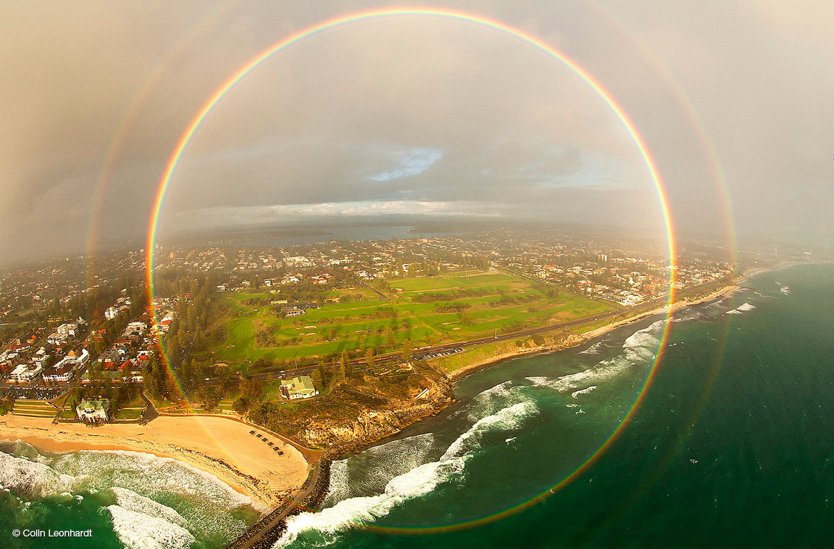
Full-circle double rainbow over Cottesloe Beach in Western Australia by Col Leonhardt, Birdseye View Photography (November, 2016 calendar)
Rainbows can be fleeting, as the rain that causes them moves or stops, so don't waste time trying to line up the perfect shot—start snapping!
Aurora australis
The aurora australis (southern lights) is best viewed from Antarctica, Tasmania and the southern coastlines of mainland Australia. They can occur at any time in the year, but are most likely in March and September – around the equinoxes – when the Earth's magnetic field is best oriented to interact with the solar wind.
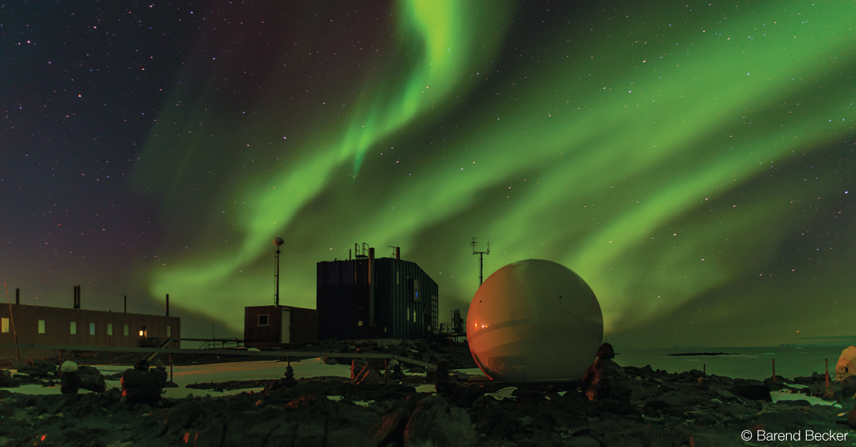
Aurora australis above Davis Station in Antarctica by Barend Becker (December, 2018 calendar)
You ideally need a dark night with little cloud cover, so check our satellite viewer before you head out. You don't want a bright moon or any light pollution, so a good location is a dark beach or a hill where you have an unobstructed view to the south.
Bright auroras usually last for 1–3 hours and the best viewing time is between 10 pm and 2 am.
When we forecast solar wind conditions that look favourable for auroras in the next 1–3 days, we issue an Aurora Watch notice at www.sws.bom.gov.au/Aurora. When there's a high chance that there will be an aurora visible now, we issue an Aurora Alert. You can sign up to receive Watches and Alerts by email or SMS.
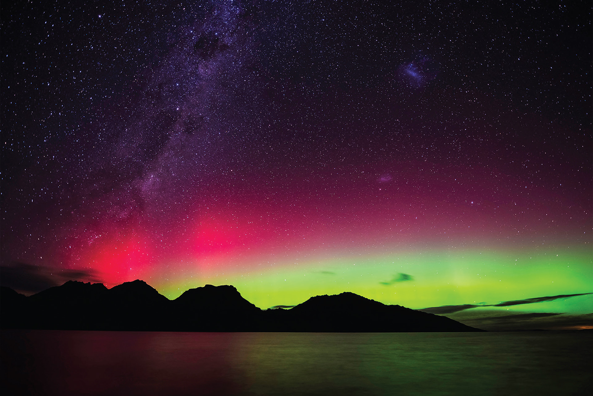
Aurora australis over the Hazard Mountains from Coles Bay in Tasmania by Ben Fewtrell, On 3 Legs (March, 2015 calendar)
You need long exposure to capture the colours in auroras, but if your exposure is too long the stars in shot will become streaks or trails as the Earth (and your view) rotates. Aurora photographer Anne Algar uses the '500 rule': Divide 500 by your focal length (in mm) and that's how long (in seconds) you can leave the shutter open before stars 'trail'. For example, 500 ÷ focal length 35 mm = 14 s shutter speed. With the shutter open so long, a sturdy tripod and remote control are useful to avoid camera movement.
Clouds and storms
Clouds are infinitely fascinating – constantly shifting size, shape, height and colour – and some of the most photogenic seem to be storm clouds.
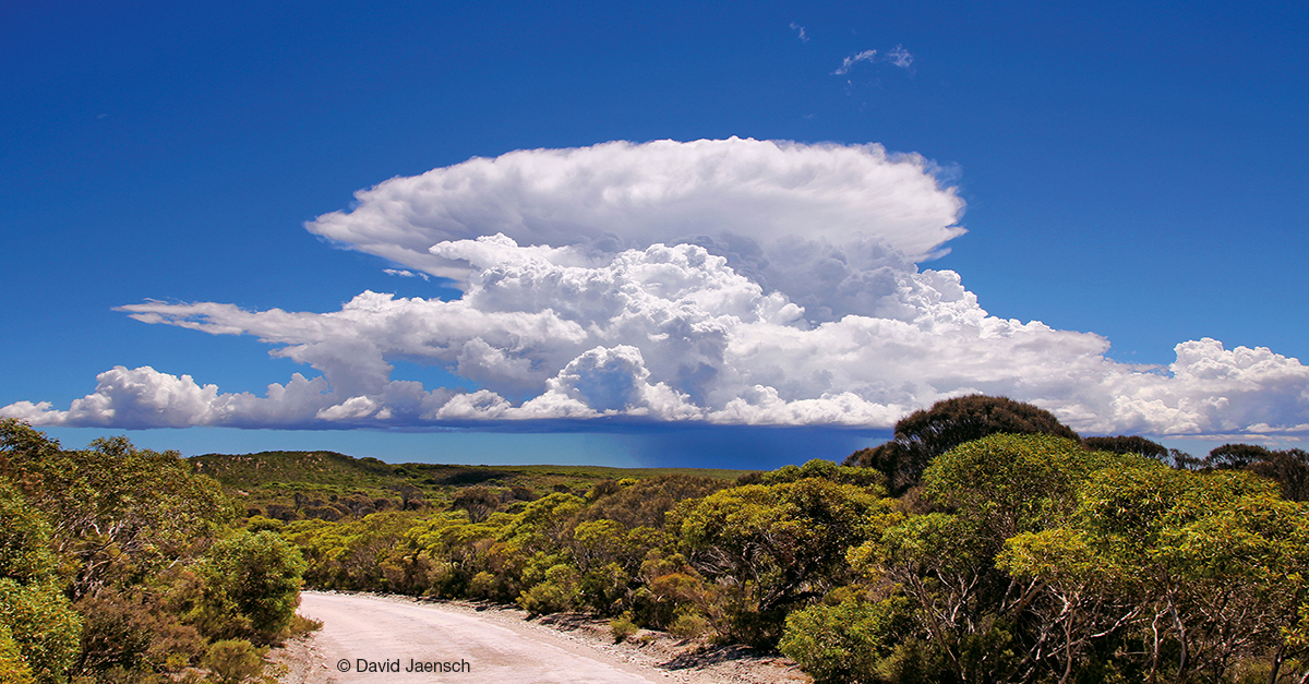
Cumulonimbus cloud over Point Lincoln in South Australia by David Jaensch (February, 2017 calendar)
David Jaensch uses our website to identify predicted storm fronts. 'I'll drive to locations near home and view the cloud formations for potential photos … If I notice an unusual weather event forming, I'll grab the camera and go for a look.' David finds a general-purpose, mid-range lens (e.g. 17–50 mm) a good compromise between a wide angle and telescopic, for those 'opportunistic moments'.
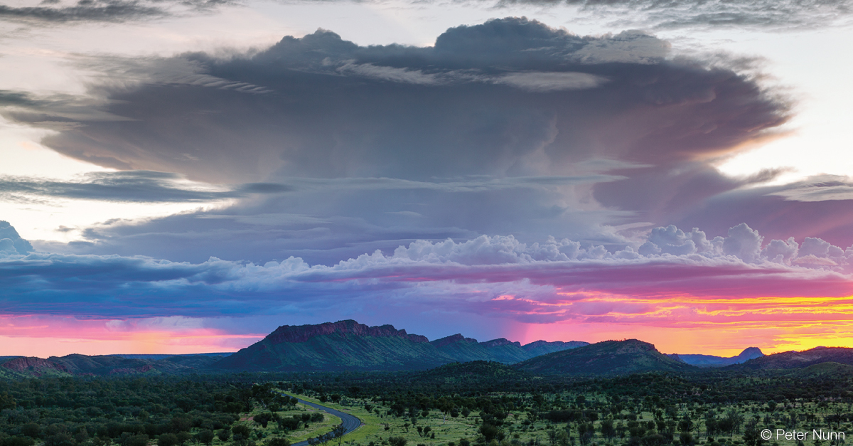
Storm cell seen across the West MacDonnell Ranges in the Northern Territory by Peter Nunn, Ninox Photography (September, 2018 calendar)
Peter Nunn advises photographers 'Get to know the best vantage points in your area. Use the Bureau's radar to spot storm cells, then put yourself in front of them in one of your favourite spots.' His winning photo was taken from one of Peter's favourite vantage points – a hill next to Larapinta Drive outside Alice Springs – where he set up to watch an incoming storm develop in the light of the setting sun.
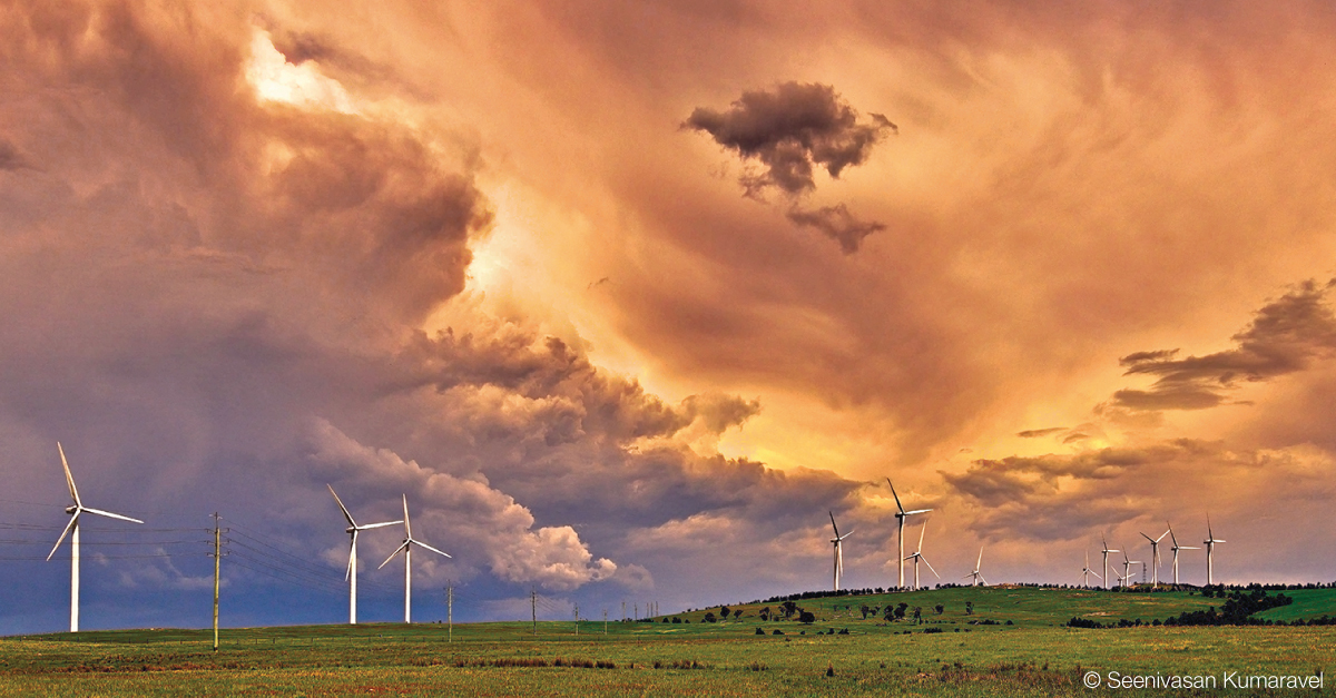
Changing skies above Capital Wind Farm near Bungendore, New South Wales, by Seenivasan Kumaravel (October, 2018 calendar)
Seenivasan Kumaravel loves a forecast of 'Partly sunny with rain later', because it means the clouds will be unpredictable. He drove up to the Capital Wind Farm near Canberra on just such a day to use the turbines as foreground.
Fog and mist
Fog and mist form in the same way as cloud, just close to the ground. As air cools, the invisible water vapour that surrounds us condenses into tiny water droplets. Air near the ground cools overnight as the ground radiates (loses) the heat that it absorbed during the day. The greatest rate of radiation occurs when skies are clear and winds are very light, which happens when a high pressure system is controlling the weather. For fog/mist to form, you also need enough moisture in the air.
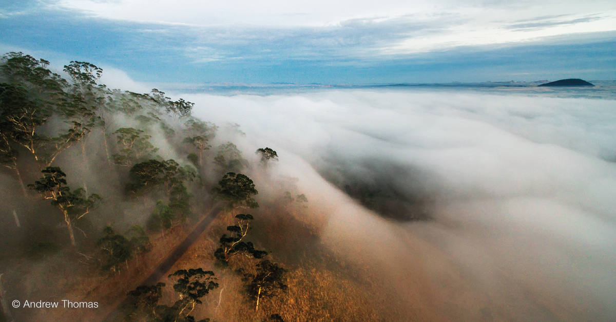
Fog around Mount Buninyong in Victoria by Andrew Thomas, Photographer (June, 2019 calendar)
Leanne Osmond (December, 2017 and 2019 calendars) says 'Fog can be elusive and often isolated in valleys. A warm day and a cool night can produce some beautiful morning mist and fog… If the fog is in a valley and you are able to get just above it, look to the west [opposite the rising sun] and you may see a fog bow!'
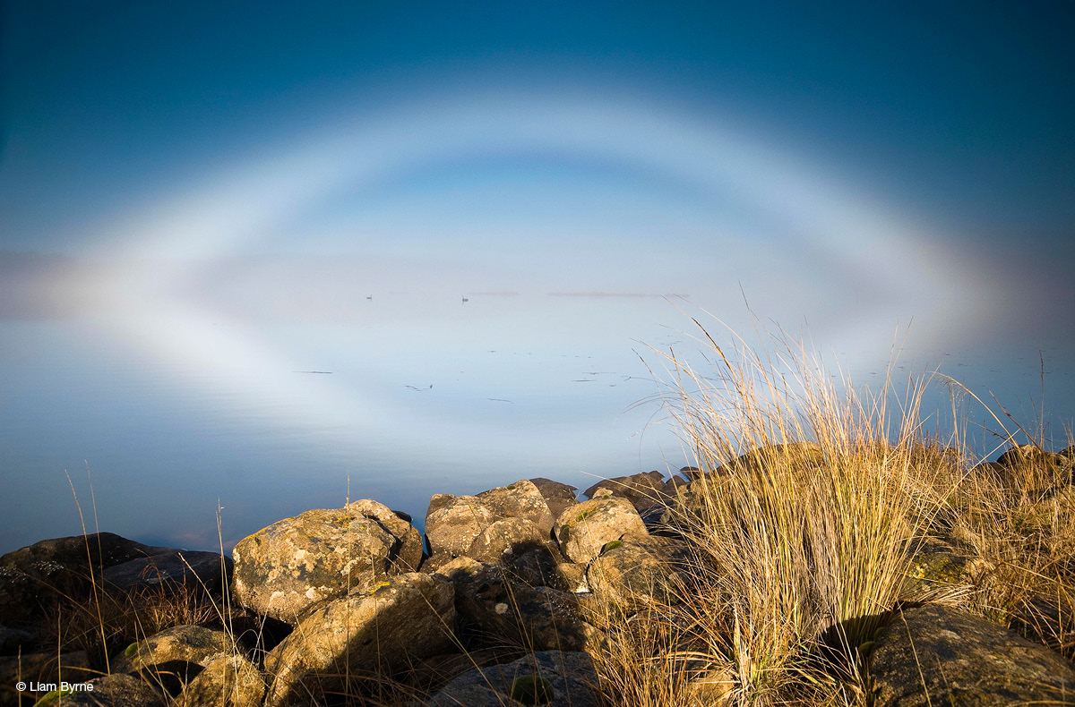
Fog bow over Great Lake, Tasmania, by Liam Byrne Photography (January, 2016 calendar)
Halos
Halos form when sun- or moonlight refracts (changes direction) through ice crystals in clouds. In Australia, you’re most likely to see halos when the sky is covered by a veil of high cloud (the cirrus cloud family). This is because temperatures high in the atmosphere where cirrus clouds form are so cold that the clouds are made of ice crystals.
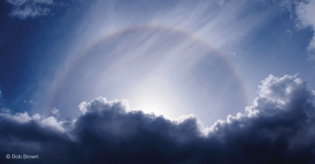
Sun halo over Melaleuca in Tasmania by Bob Brown (October, 2019 calendar)
'Most people don't even look up' says Bob Brown. If you do cast your eyes aloft when the sun is shining through high cirrus or cirrostratus, though, don't look directly at the sun. Use your hand to block it, so you can safely view the clouds around it. Take care when photographing sun halos too, if the unshielded sun is in the field of view. It’s dangerous to look at the sun through some camera viewfinders – especially SLRs.
You can safely gaze at moon halos to your heart's content, though!
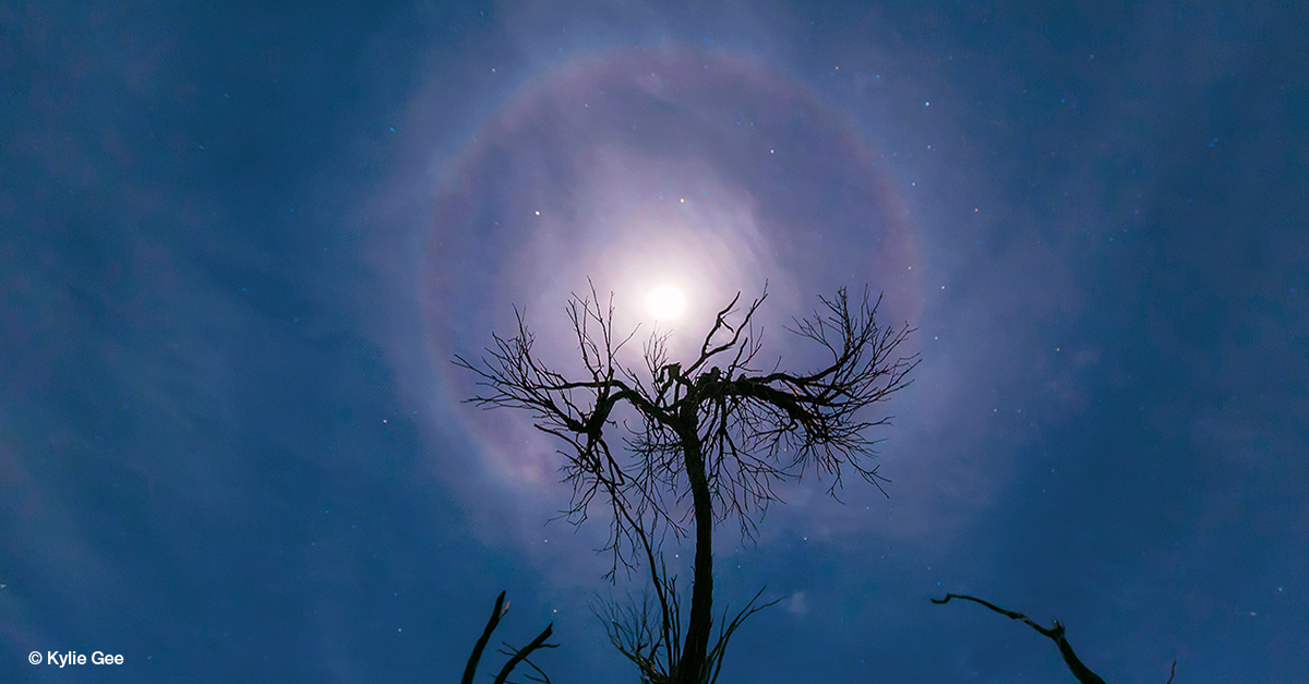
Moon halo near Bencubbin in Western Australia by Kylie Gee, Indigo Storm Photography (September, 2017 calendar)
Before Kylie Gee took the moon halo photo above, she had been aware of the tree in the photo for some time. 'I had tried to capture the Milky Way over it,' she recalls, 'but as soon as I saw the moon halo from home I knew it would work as a foreground interest and headed there to capture it. I have several locations around the area in all directions that I know will work in a landscape weather image.'
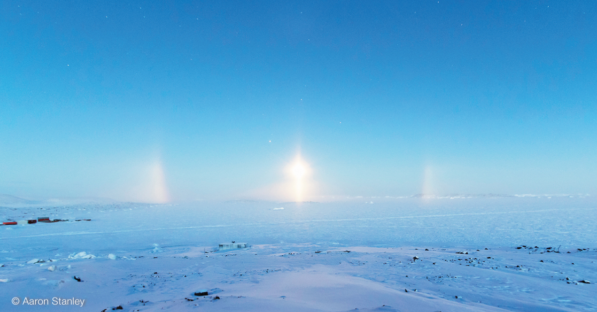
Diamond dust, partial 22° halo and light pillar over Prydz Bay in Antarctica by Aaron Stanley, APS Photography (January, 2019 calendar)
Snow, ice and frost
While much amazing weather photography deals with panoramic vistas, snow, ice and frost can offer intimate macro opportunities.
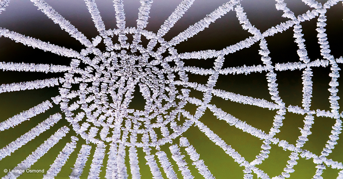
Frozen spiderweb on a fence in St Marys, Tasmania, by Leanne Osmond (December, 2017 calendar)
Leanne Osmond took the December photos in both the 2017 and 2019 calendars. She keeps a sharp eye on our weather forecasts for her part of Tasmania. Leanne's tips for photographing frost and snow are 'Make sure your batteries are charged, as the cold drains them, and make sure you dress for the conditions!' For close-up shots of spiderwebs with frost and dew drops, Leanne uses a 100 mm macro lens. 'The slightest movement can ruin a macro shot,' she finds, 'so you need as little wind as possible, and a fast shutter speed. I also find a monopod really useful for macro photography.'
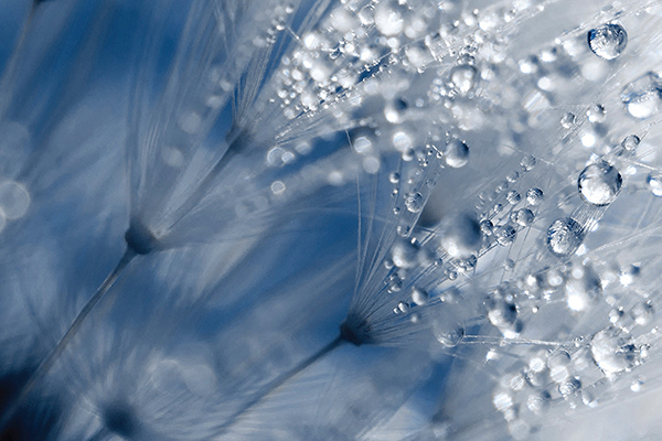
Melted frost drops on a dandelion in Kambah, ACT, by Debbie Hartley Photography (Cover, 2015 calendar)
Debbie Hartley likes to investigate what the night might have brought. 'Something that I liked to do… was go out in the early mornings and see what’s out there,' she recalls, 'because overnight anything can happen. When the sun comes up then you’ve got to start photographing really quickly or you’re going to miss it all.’
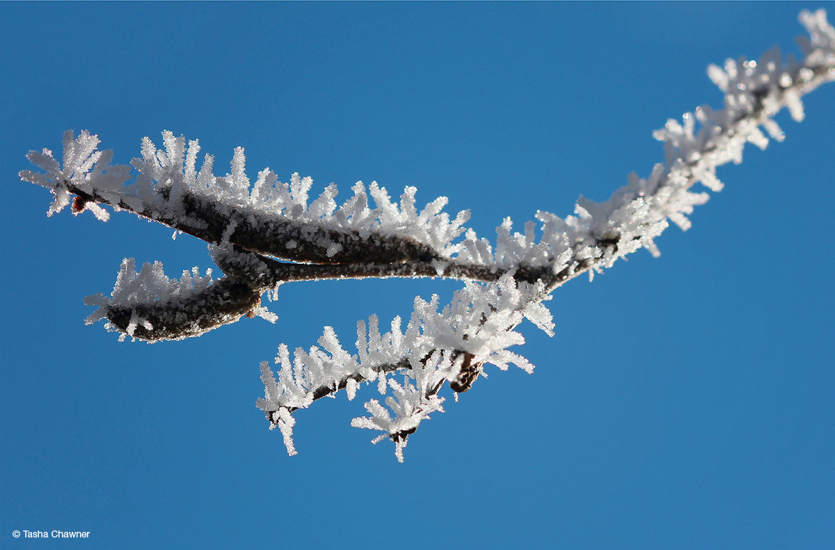
Frost on a tree in Walcha, New South Wales, by Tasha Chawner (August, 2016 calendar)
Sunsets and sunrises
At the start and end of the day, sunlight has to travel through more of the atmosphere to reach us. When light hits the atmosphere, it's scattered, particularly the blue part of the spectrum. So by the time sunlight reaches our eyes or reflects off clouds, it's mostly red and yellow light. More blue and green light is scattered when dust, smoke and other particles have built up in the atmosphere, such as under high pressure systems associated with dry and settled weather. (Read more about the science of beautiful sunsets.)
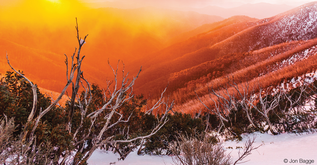
Sunset through fog at Mount Hotham in Victoria by Jon Bagge, My Light Images (January, 2018 calendar)
You can use the BOM Weather app to check sunrise and sunset times for your location. Jon Bagge is known in his local photography club as 'the sunset guy'. He finds the best colours are often visible up to an hour before the sunrises, or around 20 min. after it sets.
The other factor that can make sunrise/set photos really shine is clouds: 'Stratiform' layers of cloud high in the sky and a clear area to your east at sunrise or west at sunset make for a longer 'window' when the sun is shining up underneath the clouds. When the cloud types are clumpy 'altocumulus', each clump of cloud reflects the sunlight slightly differently, producing a variety of shades and colours. Wisps of high cirrus can also look spectacular underlit by the sun. Use our satellite viewer to see what cloud is in your area.
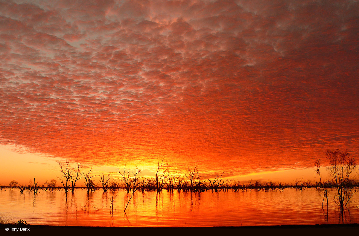
Sunset and altocumulus over Lake Pamamaroo in Menindee Lakes, New South Wales, by Tony Derix Photography (March, 2016 calendar)
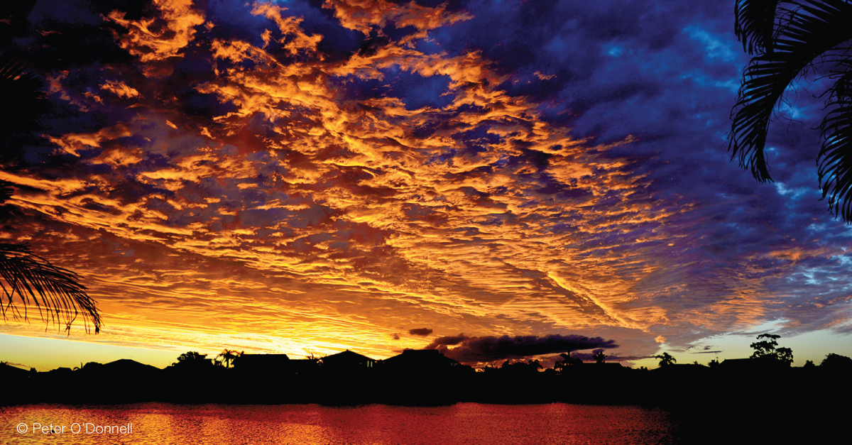
Sunset and altocumulus over Crystal Waters in Yamba, New South Wales, by Peter O'Donnell (August, 2019 calendar)
More information
You can order the Australian Weather Calendar from shop.bom.gov.au or by calling 1300 798 789. It launches in early November each year and is available until sold out.

Comment. Tell us what you think of this article.
Share. Tell others.