The science behind Australia's best weather photos
05 December 2018
Whether you're fumbling to get your phone out of your pocket in time, or poised with professional photographic gear at the ready, the weather is a huge source of inspiration for Australia's photographers. Chosen from hundreds of entries and appearing in our 2019 calendar, here are the winners of the Australian Weather Calendar photo competition. So, what's happening weather-wise in these awe-inspiring pictures?
Dazzling lightning strikes
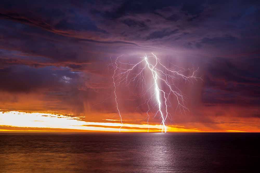
Cover photograph: Sunset-lit lightning over Gulf St Vincent, South Australia—Rowland Beardsell
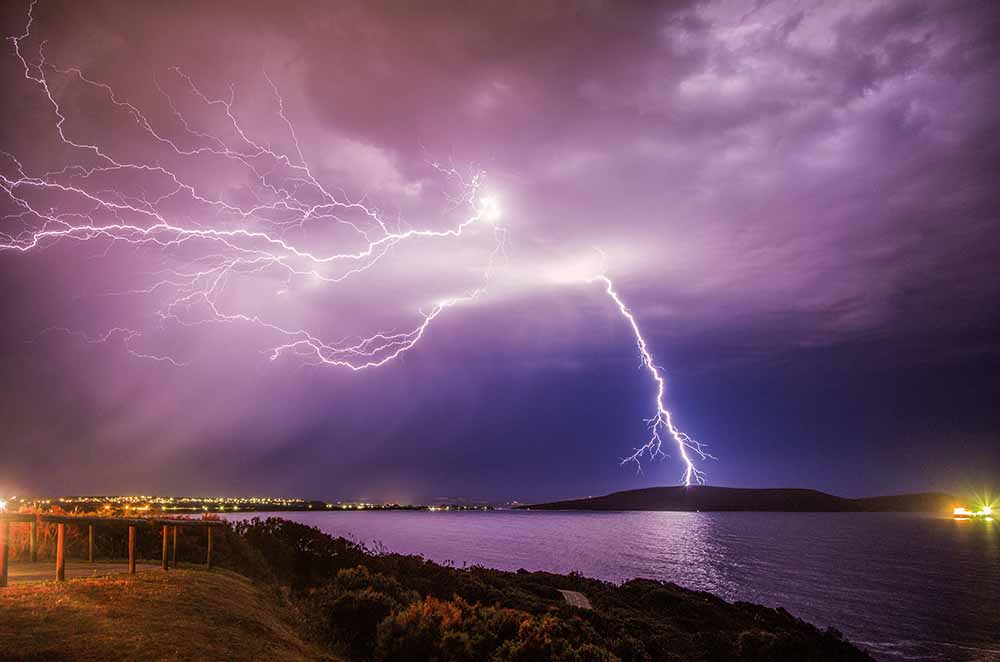
April photograph: Lightning over Middleton Beach, Albany, Western Australia—Jenny Feast Photography
Snaking through stormy skies, lightning is one of nature’s most spectacular displays—but it can also be spectacularly dangerous. The high-voltage show is caused by an electrical discharge that occurs within a thunderstorm cloud, between clouds, from clouds to the ground and even from the cloud top into the atmosphere. In the cloud, there are millions of tiny ice crystals and super-cooled water droplets rubbing against each other as they move up and down. This causes a positive charge to develop at the top of the cloud and a negative charge at the bottom. When they discharge, a powerful electric current races from the cloud to the ground and that's when we see lightning.
Read more about lightning.
Diamond dust and atmospheric optics
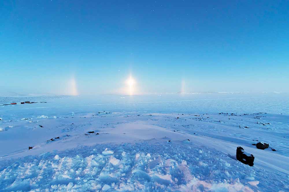
January photograph: Diamond dust, partial 22° halo and light pillar over Prydz Bay, Davis Research Station, Antarctica—Aaron Stanley, APS Photography
When the air is very cold, such as in Antarctica, ice crystals can form in the air close to the ground. This ground-level cloud is called 'diamond dust'. Interaction between light and the ice crystals can cause different optical phenomena, depending on the shape and orientation of the crystals. Light pillars, like the one at the centre of this photo, form when light reflects off ice crystals. A 22° halo, parts of which are seen here to either side of the pillar, forms when the sun or moon shines through ice crystals: as light passes through the crystals its path is refracted (bent) by 22–50°. No light is refracted at less than 22°, so an observer sees a halo around the light source.
Read more about diamond dust and atmospheric optics.
Thunderstorms up north
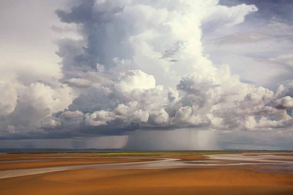
February photograph: Wet-season thunderstorm, Legune Station, Northern Territory—Elise Lawry
In the tropical region of the Top End the seasons are broadly categorised into the 'dry' and the 'wet'—though the Indigenous peoples in the area recognise several more. The wet season begins in October and runs until the end of April each year. As the end of the year approaches, temperatures increase and a shift in the prevailing wind direction brings increased moisture from warm oceans to the north of Australia. Higher temperatures and increased humidity result in the development of thunderstorms, such as this one.
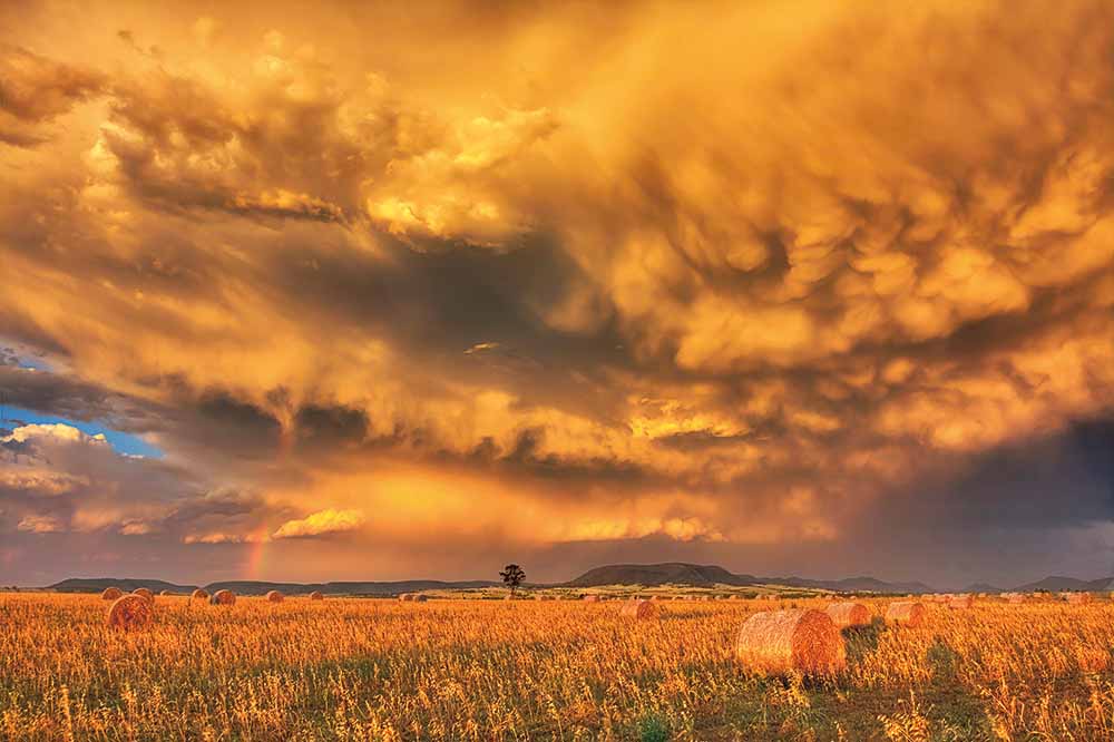
September photograph: Thunderstorm near Warwick, Queensland—Chris McFerran
Thunderstorms can occur at any time of year, but in Queensland they're most common from September to March. The frequency of storms during this period is primarily due to the increase in the sun’s energy during the warmer spring and summer months, and extra moisture coming in from the sea, which can combine with seasonal weather patterns that are favourable for storm growth.
Read more about thunderstorms
Ask BOM: What is a thunderstorm?
Cooking up a storm—how thunderstorms form
Double rainbow
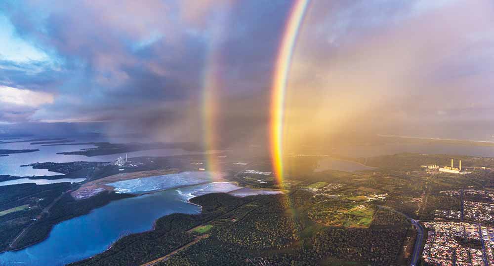
March photograph: Double rainbow over Lake Munmorah, New South Wales—Andy Smith Photography
Rainbows are formed when sunlight is refracted (bent) and reflected while passing through raindrops. Blue light refracts at a greater angle than red light, resulting in the separation of the colours in the spectrum of white light. Sometimes a dimmer secondary rainbow is visible, as seen in this photo. It is caused by a double reflection of the sunlight inside the raindrop. The colours of the secondary rainbow are inverted. In this photo, green and purple 'supernumerary' rainbows are also visible on the inside of the primary bow. These are formed due to the wave-like properties of light.
Read more about rainbows.
Fog over land and sea
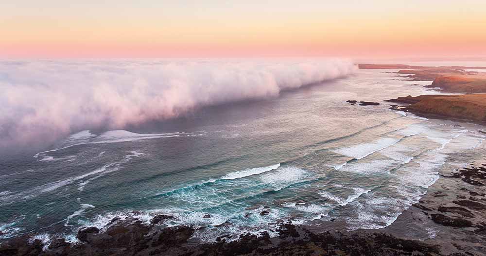
May photograph: Sea fog, Phillip Island, Victoria—Hayden Smith, Airtight Aerials
Sea fog is formed when warm and moist air passes over a cooler body of water. As the air passes over the surface of the water, it cools, and water vapour in the air condenses to form fog. Breaking waves on the beach release salt particles into the air, which help to form the fog. This kind of fog can be 'advected', or pushed, over land by the wind.
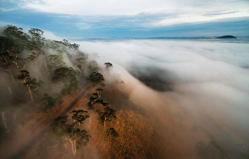
June photograph: Fog blankets Mt Buninyong, Victoria—Andrew Thomas Photographer
Fog forms when water vapour condenses into tiny droplets of liquid water, suspended in the air. This can happen in a variety of circumstances and is most common in autumn and winter under lowering temperatures and calm conditions. The fog in this photo, however, was caused by a moist upslope flow. As the moist wind moves up a slope, the water vapour in the air condenses and a fog is formed. Fog is generally a localised phenomenon and can form in small pockets when the airflow and terrain are suitable.
Read more about fog.
Cirrus clouds stretched across the sky
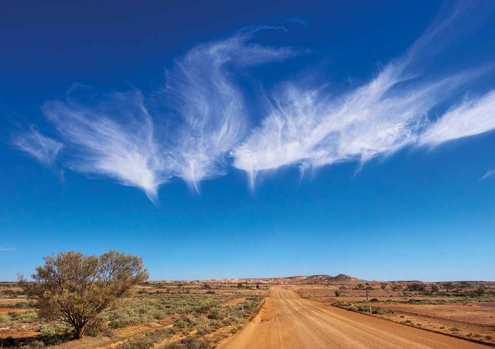
July photograph: Cirrus clouds in the jet stream, seen from the Breakaways, near Coober Pedy, South Australia—Margaret Brown
Fine white threads of cloud form a stark contrast to the brilliant blue sky in this photo. The thin and wispy clouds are known as cirrus clouds. They are made of ice crystals and are located high up in the atmosphere. Cirrus clouds often move along in a fast-flowing wind, high above the ground, known as a jet stream. This jet stream crosses Australia from west to east and is part of the general circulation of the atmosphere. It is this fast-flowing wind that gives these clouds their fine stretched-out look.
Read more about clouds
Clouds: your questions answered
Spectacular sunset
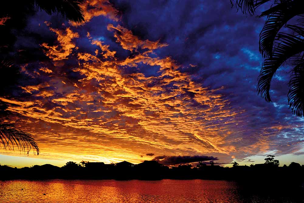
August photograph: Sunset, Clarence River, Yamba, New South Wales—Peter O'Donnell
The beautiful colours often seen at sunrise and sunset are formed by the interaction of light from the sun with the Earth’s atmosphere. At sunrise and sunset, the sun is very low on the horizon and the sunlight has a longer path through the atmosphere. As the light travels through the atmosphere, more blue and green light is scattered—leaving only red, orange and yellow hues in the direct beam. Pollution, dust and clouds reflect this light, creating a spectacular display of colour. Alto, or mid-level cloud, such as the cloud shown in this photo, tends to produce the most spectacular sunsets. Cirrus, or high-level cloud can also produce a stunning display as the sun goes down.
Read more about the science of beautiful sunsets.
Heavenly halo
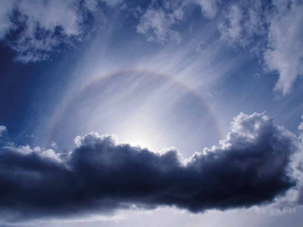
October photograph: Halo seen from Bathurst Harbour, Melaleuca, Tasmanian Wilderness World Heritage Area, Tasmania—Bob Brown
Halos form when the sun or moon shines through cirrus or cirrostratus clouds. These high, wispy clouds are made of ice crystals. A halo is formed in a similar way to a rainbow: As light passes through the ice crystals its path is refracted (bent). The angle of refraction varies from 22° to 50°, and no light is refracted at less than 22°. As a result, the observer sees a halo around the light source. The inside edge of the circle appears red because red light is refracted less than light of other colours.
Read more about halos.
Supercell thunderstorm
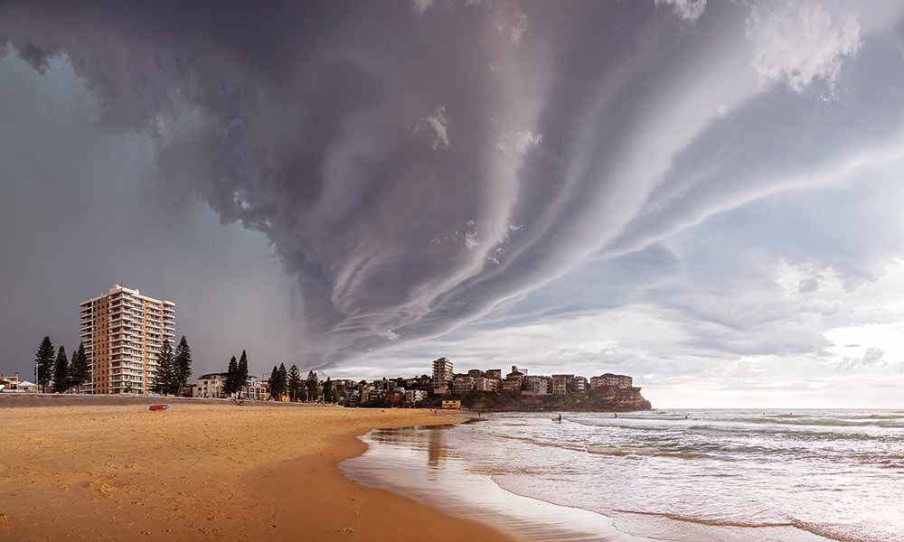
November photograph: A supercell thunderstorm looms over Manly Beach, Sydney, New South Wales—Mauricio Bacchi Photography
The ominous supercell thunderstorm in this photo was generated as a cold front moved across New South Wales. A supercell is a very strong, long-lived type of thunderstorm that can maintain itself for many hours. Supercells are characterised by internal rotation and a continuous large updraught. Their size, longevity and potential for severe weather conditions make them quite dangerous. They are generally the most severe thunderstorms we experience. This one displays spectacular arcus, or shelf clouds. These low, horizontal wedge-shaped clouds attached to the base of the parent cloud are formed by the outflow from the thunderstorm.
Watch a short Ask BOM video: What is a severe thunderstorm?
Hanging icicles
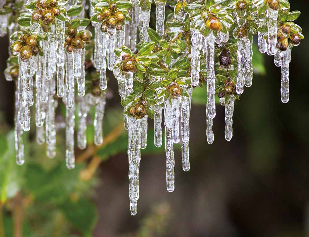
December photograph: Icicles hang from branches, Liffey, Tasmania—Leanne Osmond, Leeo Photography
Icicles can form when the air temperature is below freezing (0 °C), there is snow or ice around, and the sun is shining. The sunshine warms and melts the surface of the snow or ice a little. This water then runs along until it drips off a branch, leaf or other overhanging object. As the water drips, it refreezes in the very cold air, forming the base of an icicle. The icicle grows as drop after drop of water runs down it and freezes onto it.
More information
Buy the 2019 Australian Weather Calendar
Australian Weather Calendar photo competition

Subscribe to this blog to receive an email alert when new articles are published.

Comment. Tell us what you think of this article.
Share. Tell others.