More snow on the horizon for Tasmania
03/08/2015

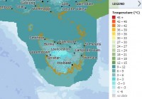
The Bureau of Meteorology is forecasting more snow to reach low elevations in Tasmania this week.
Regional Director for Tasmania, John Bally, noted that very cold temperatures Monday night will see icy conditions on roads tonight and tomorrow morning.
“Snow is forecast to continue to fall about the state tonight and tomorrow, but the snow line will gradually rise tonight, affecting mostly highland areas. Tuesday night the snow line will start to lower again, when we are likely to see snow fall to low elevations again,” Mr Bally said.
Another burst of cold air on Wednesday morning will produce more showers and snow across much of the state, settling to around 300 to 400 metres.
Lower falls to around 100 metres in the west and south of state are also possible.
“Repeat snowfalls may lead to continuing road closures across the highlands on Tuesday and Wednesday, and for the lower parts of the west and south on Wednesday morning.
“While snow is possible in Hobart again on Wednesday, at this stage we are not expecting snow to be as heavy or as low as it has been today,” Mr Bally said.
Snow to sea level in Tasmania is relatively rare. Significant falls were recorded 24-25 July 1986, when snow was reported across much of the state, including around 10cm in Hobart. While there have been several reports of light snowfalls since, today’s snowfall event is probably the most significant event since 1986.
The Bureau of Meteorology will continue to issue warnings for specific regions, for the advice of road users, sheep graziers and bush walkers.
For further information go to the Bureau’s website for the latest Warnings.
Check the Tasmania Police website for further information on road closures.
The Bureau is also now using Twitter to disseminate significant weather information for the community. Follow @BOM_TAS for updates on this snow event.
The Bureau’s website remains the most up-to-date and comprehensive official source of weather information.


