Post-event report on Severe Tropical Cyclone Lam released
24/11/2015

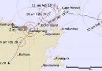
Severe tropical cyclone Lam was the first cyclone for the 2014–15 cyclone season in the Northern Region, and the first severe cyclone to cross the Northern Territory coast for nearly a decade. The destructive core of the cyclone impacted three relatively large Northern Territory communities — Galiwin'ku, Milingimbi and Ramingining.
The Bureau of Meteorology tracked the full life cycle of the system for some 11 days, issued 67 Tropical Cyclone Advices (including 54 consecutive hourly updates leading into landfall), 14 Severe Weather Warnings, 8 Flood Warnings and 7 Flood Watches.
The Gove and Warruwi radars provided high-quality, 10 minute radar image updates for forecasters and communities across north eastern Arnhem Land throughout the event.
Assessment of the recovered data from the Bureau’s Automatic Weather Station network, as well as a survey of damage to infrastructure and vegetation in affected communities, suggests that Elcho Island and Milingimbi experienced low-end category 3 winds, while Ramingining likely experienced high-end category 3 winds.
An aerial survey of the remote areas surrounding the location of landfall suggests that damage to coastlines and vegetation was more extensive than that observed in the communities of Galiwin'ku, Milingimbi and Ramingining. Indications from the damage assessment suggest that Lam was a category 4 cyclone at landfall.
Download the full report here.


