


Monsoon trough brings increased risk of cyclone & floods
24/12/2015
The monsoon trough has developed across northern Australia bringing with it the increased risk of a tropical cyclone forming.
A low pressure system is currently located over the north western Top End in the Northern Territory (NT), and is expected to track eastward, moving into the Gulf of Carpentaria late on Friday (25 December).
Once over the Gulf of Carpentaria, the low is expected to intensify further into a tropical cyclone over the weekend.
In Queensland, northern parts of the Gulf Country and much of the Peninsula district can expect periods of heavy rain and isolated gusty thunderstorms with locally heavy falls over the next few days.
The flood watch for coastal catchments north of Townsville and the flood warning on the Daintree River have been finalised. However, the North Tropical Coast and Tablelands will see further rainfall, possibly with localised heavy falls, which may extend into parts of the Northern Goldfields and Upper Flinders districts during Christmas Day and Boxing Day.
Very windy conditions are expected to affect the Gulf of Carpentaria waters over the Christmas period as the monsoon trough becomes more active.
In the NT Severe Weather Warnings continue for Tiwi, parts of the Daly, Arnhem and east Carpentaria districts for thunderstorms, with damaging wind gusts and heavy rainfall that may lead to flash flooding.
Possible destructive wind gusts of around 125 km/h are also possible over the Tiwi, northern Daly and north west Arnhem districts.
A Flood Watch remains current for the North West coastal rivers, where some strong river rises have been observed. The Flood Watch also now extends into the Arnhem and Carpentaria Districts, as rain areas are expected to extend eastwards over the next few days as the low moves towards the Gulf of Carpentaria.
Very heavy surf is expected along coastal parts of the north east Arnhem district, which may lead to localised damage and coastal erosion.
Very windy conditions continue to affect coastal waters of the NT, and gales are forecast for the north and east maritime areas.
During the 24 hours to 9am on Thursday (24 December) rainfall totals of 100-200 mm occurred over the north west Top End, and in Queensland's North Tropical Coast and parts of the Peninsula. Wind gusts of 80 – 90km/h have also been recorded at some NT coastal stations.
The Bureau of Meteorology will be operational throughout the Christmas period and will continue to monitor the situation in the NT and Queensland closely.
Media resources
The Bureau continuously monitors the potential for tropical cyclone development and will provide an updated Tropical Cyclone Outlook each day.
Media can download the Bureau’s Understanding Cyclone Intensity video and other media resources to support the delivery of cyclone warning information for the Australian public.
Keep up to date with forecasts and warnings at: www.bom.gov.au/warnings
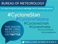
Follow us on Twitter
The Bureau is also using Twitter to disseminate significant weather information to the Northern Territory and Queensland community, follow @BOM_NT and @BOM_Qld
This tropical cyclone season we’re using hashtags starting #Cyclone, for example:
#CycloneStan | #CycloneTatiana | #CycloneUriah | #CycloneYvette | #CycloneAlfred | #CycloneBlanche
