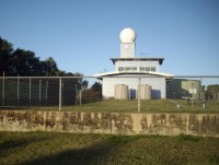
Mackay weather radar upgrade to provide coverage around the clock
11/10/2016

The Bureau of Meteorology has completed the installation of an automatic wind profiler at Mackay Turf Club, providing real-time wind measurements of the upper atmosphere in the Mackay region for use by pilots and forecasters.
Acting Queensland Regional Director Bruce Gunn said this now removes the requirement for wind observations by the weather radar at Mt Bassett, allowing continuous monitoring of rain and thunderstorms.
"These improvements in radar coverage have been prioritised for delivery ahead of the northern
wet season, when there is an increased risk of thunderstorms and tropical cyclone activity
in Queensland," Mr Gunn said.
"Now, with the installation of better on-the-ground weather observation infrastructure and vast improvements in satellite technology, the Bureau is able to gather more meteorological data,
more frequently. This, combined with a leap in computing capacity, is driving big improvements
in forecasting."
Prior to the installation of the wind profiler, wind observations at Mackay were collected by weather balloons, released manually by staff. As a result, radar images were not available to the public for several hours each day while the radar was used for tracking the manually released weather balloons.
A range of industries rely on weather information for planning their activities. Examples include agricultural producers in crop spraying, construction workers in planning concreting or painting, shipping and recreational fishing in planning to go out on the water, and for the mining and resources sectors in planning their operations.
In addition to continuous radar coverage, the community now has access to the Next Generation Forecast and Warning System through MetEye, a service providing seven day forecasts across the continent and into surrounding coastal waters down to fine-scale (6km x 6km resolution). MetEye provides a level of service for regional Australia that was previously only available in metropolitan cities.
The frequency and resolution of available satellite imagery increased significantly last year with the launch of the Japanese satellite, Himawari-8. These images are now publicly available, and refreshed every 10 minutes on the Bureau's website.
All of these initiatives provide an enhanced level of weather monitoring and forecasting throughout regional Australia, helping to support a better-informed and safer communities.
As has been the case for many years, specialist severe weather and flood forecasting advice for emergency services in Mackay continue to come from the Bureau's Queensland Regional Office in Brisbane.
For further information go to our Learn About Australian Watch Radar information page. View the Mackay Radar Loop.


