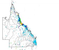
Rain for southwest, flooding eases for the coast
20/10/2017

A trough moving through southern inland regions today will bring rain to the coast on Saturday, but is not expected to deliver the high rainfall totals seen earlier in the week.
The cloud band has already delivered some welcome relief for southwestern Queenlsland. The Bulloo and Paroo Rivers will be monitored over the weekend as minor flooding may occur. The rain band will shift into eastern districts on Saturday producing generally 10 to 30mm of rain, and easing as it moves to the east coast.
Areas recently affected in the Wide Bay and Burnett region are not expected to be significantly impacted by the latest weather system. Flood levels are easing for all catchments, and will continue to be monitored over the weekend.
October rainfall records
The combined rainfall totals from this week and earlier this month, have seen new October records as shown below:
- Bundaberg 533mm – previously 281mm in 1953
- Hervey Bay 403mm – previously 208mm in 1987
- Town of Seventeen Seventy 281mm – previously 161mm in 1970
Queensland Fire and Emergency Services is urging the public to stay tuned for the latest official forecasts and warnings from the Bureau of Meteorology, and follow the advice of local emergency services. Avoid travel if possible while warnings are in place and remember: if it’s flooded, forget it.
Follow us on Twitter @BOM_Qld
The Bureau's website remains the most up-to-date and comprehensive official source of information.


