Severe weather update: Heavy rain and flooding in southeastern Australia
01/12/2017

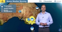
METEOROLOGIST ADAM MORGAN:Hello from the Bureau with the latest update on the heavy rain and flooding expected across southeast Australia. We'll also cast our eye towards early next week and look a little closer at potential for rain in parts of eastern
Queensland and a possible East Coast Low off New South Wales. Let's go straight to the current warnings: We've got a severe weather warning in place for heavy rainfall across most of Victoria and parts of south and central New South Wales, where there's also a risk of damaging winds. The heavy rain and damaging wind risk across areas of South Australia is more likely to come from thunderstorms, and so we may see Severe Thunderstorm Warnings issued during
Friday afternoon. Now Flood Watches (our 'heads up' for riverine flooding) are in place for numerous river catchments across Victoria, southern New South Wales, Tasmania and even parts of eastern Queensland ahead of rain expected there on Sunday and Monday.
Now this weather system began with thunderstorms across South Australia during Thursday, where some damaging wind gusts were recorded at places like Port Pirie, Snowtown and Oodnadatta.
Now rain and storms moved into Victoria overnight and we've seen rain develop through areas of central Victoria and parts of the Melbourne metro area this morning. This remains a major rain event and there's still a major flood risk for many parts of Victoria and southern New South Wales,but overnight computer weather model information suggests we'll see a slight shift towards the east in where some of the heavier rain may fall. Now there's no change for areas of northeast Victoria and southeast New South Wales.
In northeast Victoria, particularly along the Ranges, some places may see in excess of 250 mm in the three days between Friday and Sunday. In southern Victoria, though, the heavier rain risk looks to have moved slightly further east towards East Gippsland and away from the Melbourne region.
But this doesn't mean, though, that the risk has passed for the metro area. Even with the rain still expected, river systems in the Melbourne metro area are still at risk of flooding. Now the weather pattern in the upper atmosphere responsible for this weather hasn't changed.
We're still seeing this sharp upper trough through the Bight and the split in the Jet Stream which promotes rain and thunderstorm development to the east. At the surface, the low pressure system intensifies over the southeast on Friday, with a trough hanging back through northeast South Australia. Now people in Melbourne can expect to see a break in the weather during Friday afternoon and evening as the southwesterly change moves in, but then rain becomes heavier again overnight and into the early hours of Saturday morning. The rain will intensify then during Saturday across northern Victoria and southeast New South Wales, and then on Sunday the low moves further southeast and into the Tasman Sea.
Now as the trough moves further east, areas of eastern and southern Queensland may see heavier rain develop during Sunday and Monday, and on the back of recent heavy rain keep an eye on the Flood Watch for how flooding impacts may develop.
And finally there may even be a risk of an East Coast low developing off the coast of New South Wales during the early and middle part of next week, and we'll be monitoring that situation closely over the coming days. At this stage our computer models suggest that the system and the heavier rain will remain offshore, but there may be coastal impacts if that weather system does move a little further west towards the coast.
Now these events will impact large areas of eastern Australia; so please, over the coming days as the rain and floods develop, make sure to head to the Bureau's website and app for all the latest Watches and Warnings. Join us on Twitter for updates direct from the Bureau's meteorologists throughout the event, and follow all advice from emergency services.


