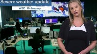
SEVERE WEATHER UPDATE: Developing tropical low in Western Australia
10/01/2018

METEOROLOGIST ANDREA PEACE: Hello from the Bureau, where we continue to monitor a developing tropical low, which is slowly moving offshore from the west Kimberley coast. This is a broad system that still has some developing to do before it reaches cyclone intensity.
Since 9am yesterday, thunderstorm activity around the low has resulted in rainfall totals between 20 and 90 mm over the northwest Kimberley – most of the thunderstorm activity has been on the western flank of the low, over the warm tropical waters.
There is now a warning area for coastal communities between Kuri Bay and Wallal Downs, including Broome, where gale force winds with gusts up to 100 kilometres per hour may develop in the next 24 hours. A watch area remains in place between Wallal and Port Hedland, as well as remaining inland parts of the northeast Pilbara, including Marble Bar and Telfer and the far western Kimberley. These areas may see gale force winds develop later on Thursday or early Friday.
As the low moves offshore during today, it will draw in energy from the warm tropical waters and may develop into a tropical cyclone overnight or during Thursday morning.
There is still some inconsistency between the track that the computer models take the cyclone, which is why we see a broad shaded uncertainty area, particularly as we head into Friday and Saturday. However as we move closer to the cyclone forming, confidence is growing that it will remain fairly close to the coast, and may just have enough time over water to reach that severe category three cyclone intensity, with wind gusts in excess of 165 km/h.
Heavy rainfall is expected over the west Kimberley coast today, extending to the far eastern Pilbara during Thursday. Widespread daily rainfall totals of around 50 to 150 mm are expected with isolated heavier falls of 150-300 mm possible.
An initial flood warning has been issued for the Ord River as a result of the past 48 hours of heavy rainfall through the catchment.
Flood watches have been issued for a number of catchments in the Kimberley and Pilbara regions where heavy rain may lead to flooding over the coming days.
So if you are in the northwest of WA, keep checking for the latest forecasts and warnings on our website and app and you can also get updates directly from Bureau forecasters via Twitter.
And of course, follow all advice from the Western Australia Department of Fire and Emergency Services.


