SEVERE WEATHER UPDATE: Tropical cyclone Joyce
12/01/2018

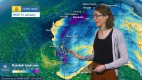
METEOROLOGIST SARAH FITTON: Hello from the Bureau, with an update on tropical cyclone Joyce. The Category 1 system tracked off the west Kimberley coast last night; however, early this morning it took this abrupt change to the southeast and it's current lying close to land. The system is likely to track close to the coast for the remainder of today, before moving inland and weakening later on.
Now cyclones need this warm tropical moisture to strengthen, so this small change in cyclone Joyce’s position has made a very big difference in its forecast intensity. So fortunately this means that residents of northwest WA will be spared the impact of a 'severe' tropical cyclone, however there are still some hazardous conditions associated with the system.
Heavy rainfall has been falling from these cloudbands, which are wrapping around the cyclone, and we've seen 172 mm at Anna Plains and 150 mm at Mandora, where 70 mm of rain fell in just three hours this morning.
We have a Cyclone Warning current and gales with gusts up to 100 km/h possible in the far western Kimberley and the eastern Pilbara, and heavy rainfall is also expected in these areas today—extending through into central Pilbara and inland parts of the Gascoyne during Saturday and Sunday.
Widespread daily rainfall totals of 50–100 mm are expected, with isolated heavier falls of 100–250 mm possible near the system’s centre. And the remnants of the system will head further southwest over coming days, bringing rainfall to western and southern parts of the State. And even Perth may see some rainfall; however, falls in Perth are likely to be lower than in other areas, and there's still uncertainty over the timing and amount of the rainfall.
We have a Flood Warning current for the West Kimberley catchment and Flood Watches are current for a number of catchments in the Pilbara, which are already fairly wet due to recent heavy rainfall from tropical cyclone Hilda. Forecast rainfall in these affected catchments is expected to result in river rises, areas of flooding and may adversely affect road conditions.
So keep checking for the latest forecasts and warnings on our website and the BOM Weather app. You can also get updates directly from our forecasters via Twitter.
And please follow all advice from the Western Australian Department of Fire and Emergency Services.
To view the video, click here Severe Weather Update: tropical cyclone Joyce


