WEATHER UPDATE: Major flooding along North Tropical Coast of Queensland
09/03/2018

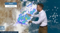
SENIOR METEOROLOGIST, ADAM MORGAN: Hello from the Bureau with an update on major flooding along the North Tropical Coast of Queensland following four straight days of heavy rain.
This flood situation has seen communities isolated, schools closed and highways cut, with overall flood impacts comparable to the February 2009 flood event.
Let's go straight to the current warnings.
There's a record major flood in the Murray River at Murray Flats, expected to peak possibly around 9 metres during Friday afternoon.
Levels on the Tully River at Euramo are forecast close to the major flood level during Friday afternoon.
The main focus today remains on the Herbert River. The flood peak is currently around Ingham Pump Station and major flood levels are around 14.7 metres. A major flood peak similar to the February 2009 floods is expected at Ingham during Friday afternoon.
There's also a host of minor to moderate flood warnings for other river systems.
Over the past 24 hours the rain has continued to stream onto the North Tropical Coast and ranges now for the fourth day running.
This persistent line of rain and thunderstorms has been maintained by an area of converging winds over the Coral Sea.
What makes the rain even more intense in this part of the world when we have east or southeasterly winds are the mountains that sit very close to the coast.
When the moist air comes onshore, it hits the ranges and has only one way to go – straight up. This generates even more cloud and intensifies the rainfall.
The highest rainfall in the 24 hours to 9 am Friday was 409 mm at Kirrama Range.
But over the past four days, we've seen 853 mm at Bulgun Creek, with widespread totals in the range of 500 to 700 mm. 621 mm fell at Tully, 403 at Innisfail and 322 at Cairns Racecourse.
What's unique this time around too is that very heavy rain extended further inland from the coast than we'd normally see in these situation, which means stronger flood peaks in through the upper reaches of many river systems.
Although showers will continue along the coast into early next week, the heavy rain should gradually clear south of about Cairns by the end of Friday night.
That doesn't mean the flood threat is over yet though, as flood peaks gradually progress downstream though river systems towards the coast.
Turning our attention briefly back towards the Gulf of Carpentaria, we'll keep our eye on the strengthening monsoon over the weekend.
The monsoon trough will gradually move into the northern Gulf by Sunday, but compared to earlier this week, any significant development of this low now looks to be pushed back a little into early next week.
Conditions in the atmosphere do still look favourable for the potential development of a tropical cyclone next week, but for the next 3 days at least the risk of cyclone formation remains low.
So as always, stay tuned to the latest official forecasts and warnings on our website and app. Join us on Twitter for updates direct from the Bureau's weather and flood teams, and follow all advice from emergency services.


