Southerly surge to chill NT's south and dry the north
25/05/2021

A cool change is currently working its way north through central Australia. By Thursday the Northern Territory's Top End will return to true dry season conditions.
The Top End's dry burst will be accompanied by strong winds, and is likely to lead to marine wind warnings from Wednesday to Friday.
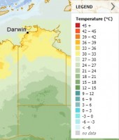
The cold front in the south will drop temperatures from a maximum of 24°C today in Alice Springs to high teens from tomorrow through most of the week. It's forecast to return to a max in the mid-20s on Monday.
Tennant Creek is expected to only reach a high of mid twenties from Thursday, following a high of 31°C today. Even Darwin will dip slightly from a max of 33°C this week to 31°C from Saturday.
Morning frost is possible around Alice Springs from Thursday. A very cool 1°C Saturday night/Sunday morning is forecast.
A weak cloud band associated with the cold change is expected to cause showers today and tomorrow west of Alice Springs. It's possible showers will return to the south west corner including Giles from Sunday that extend to Yulara from Tuesday next week.
Conditions should be favourable for watching Wednesday night's total lunar eclipse. The eclipse begins at 7.15pm, goes into total eclipse from 8.41pm to 8.56pm and will end at 10.22pm. It's not a weather phenomenon so isn't included in Bureau forecasts, but this external site has more information.
ENDS


